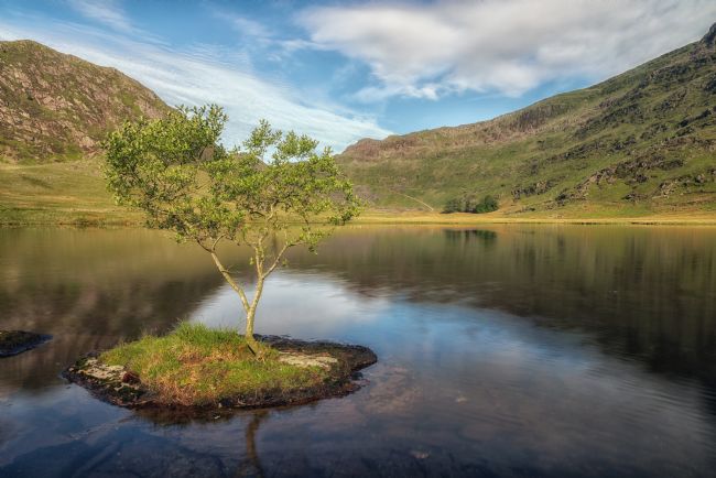
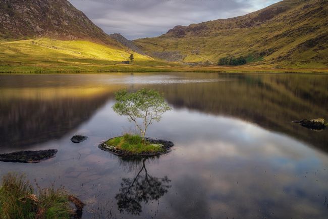
Deep in Snowdonia lies a lake across which an island once floated. In folklore, this is not unusual. St Brendan’s Isles drifted around the globe for centuries, and seven of Britain’s canonised saints apparently floated to our shores on a sod. But in this case, the island was real, and unusual enough for Edmund Halley the astronomer to swim out and see for himself in 1698. He described a piece of turf broken loose from the bank and buoyed up by the lightness of “broad-spreading fungous roots on its sides”.
Others will tell you it was the tylwyth teg – the fairy folk – who created the floating island on Llyn y Dywarchen. Respect must be paid to the mischievous tylwyth teg. Their world is a shifting one. They thwarted me with bogs, felled trees, redirected paths, vanishing buses, and even conspired to send me to the wrong lake. There is, it transpires, more than one Llyn y Dywarchen.
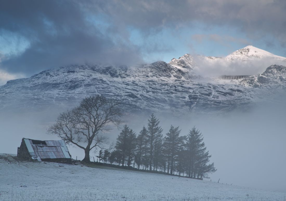
An old farmhouse barn on the outskirts of Llan Ffestiniog. The dam you see in the mountain forms part of the ffestiniog Power station Pumped storage scheme.
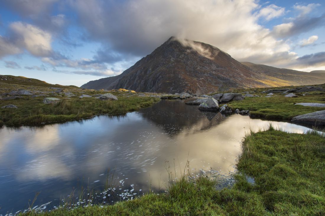
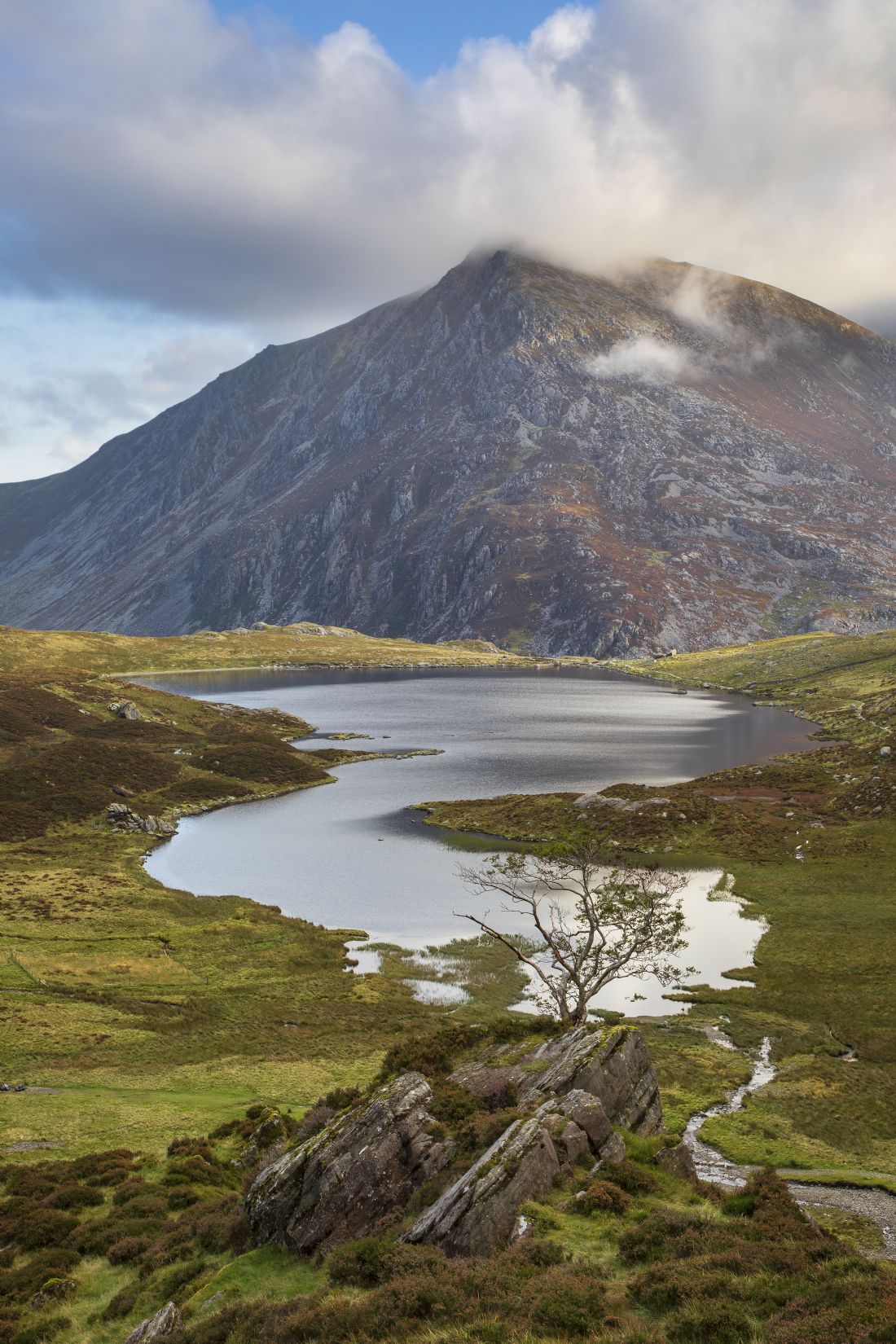
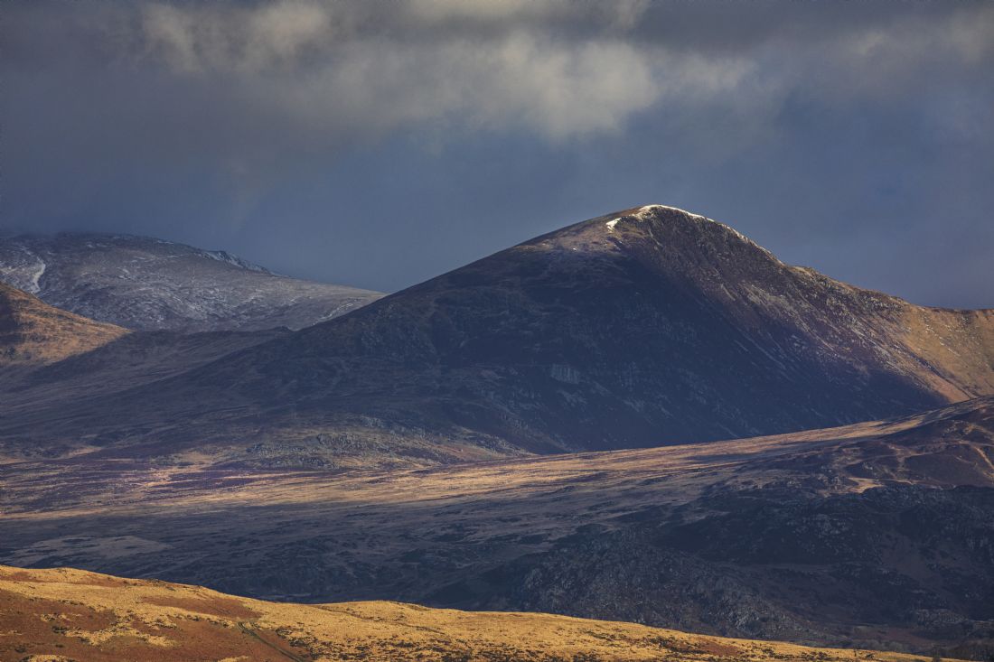
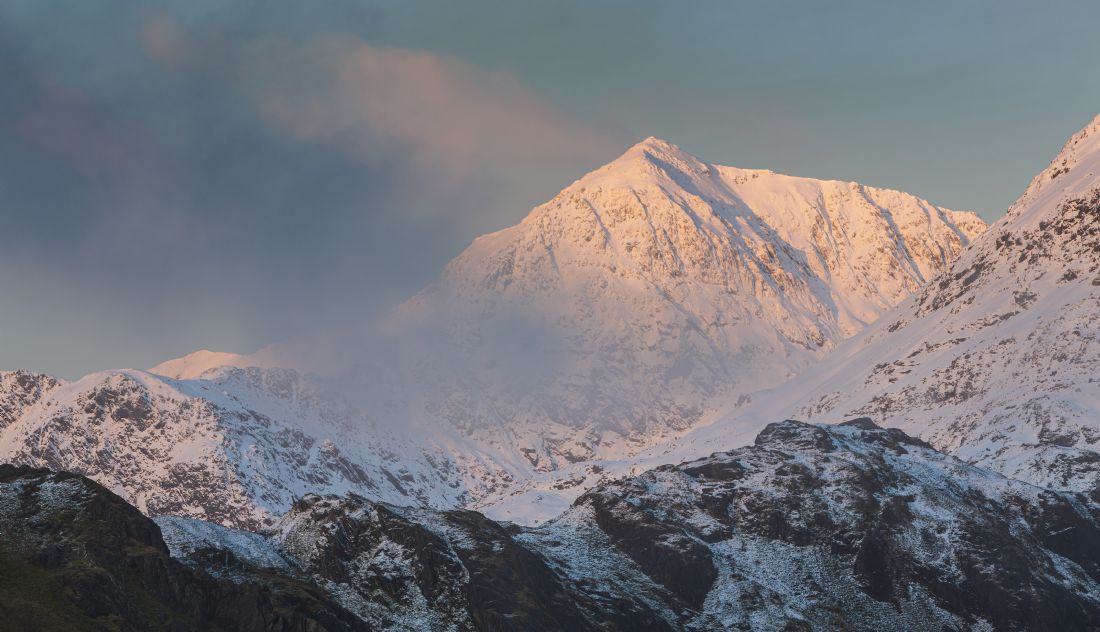
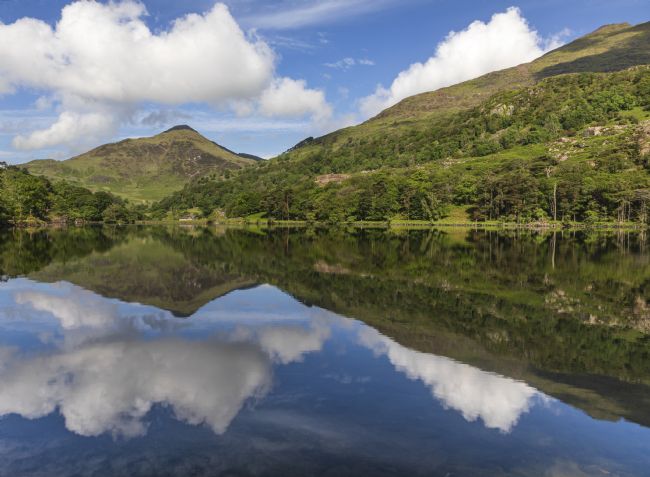
A view of Pen yr Ole Wen, part of the carneddau mountain range, from Cwm Idwal.
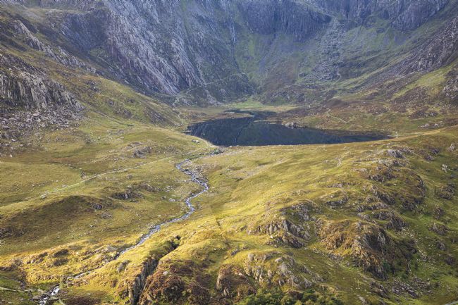
Llyn Idwal is a small lake that lies within Cwm Idwal in the Glyderau mountains of Snowdonia. It is named after Prince Idwal Foel, a grandson of Rhodri Mawr, one of the ancient Kings of Wales. Legend states that the king's unfortunate offspring was murdered by being drowned in the lake.
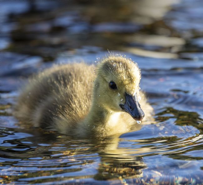
Gosling is a specialized term for a young baby goose, typically still covered with soft, fluffy down feathers and unable to fly. Because these chicks are precocial, however, even at a young age they can easily forage on their own and both walk and swim well.
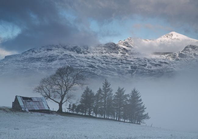
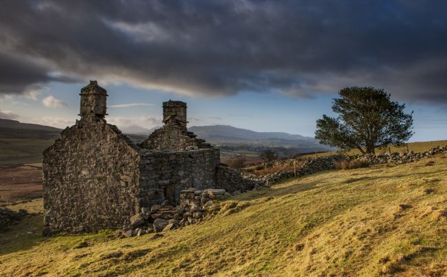
An abandoned farmhouse on the foothills of Manod Mawr at Blaenau Ffestiniog, North Wales
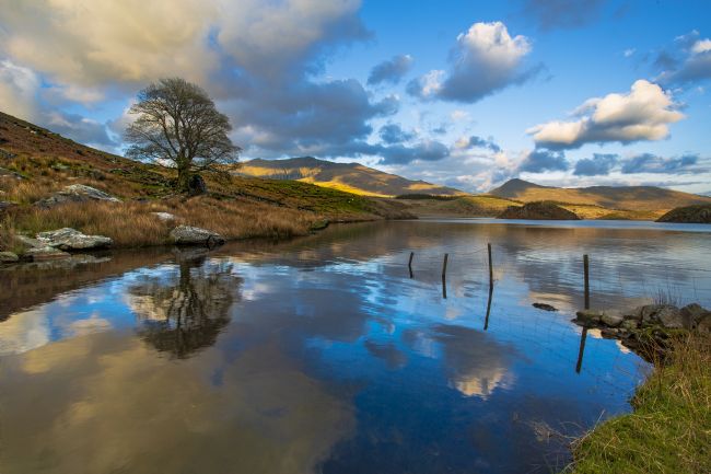
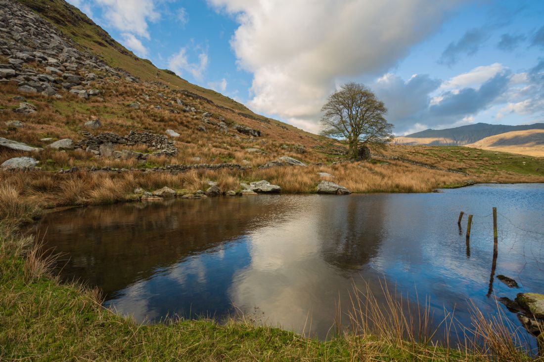
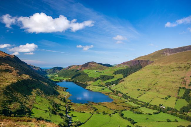
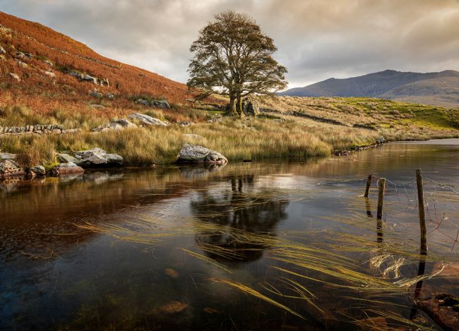
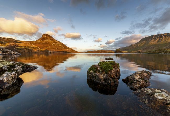
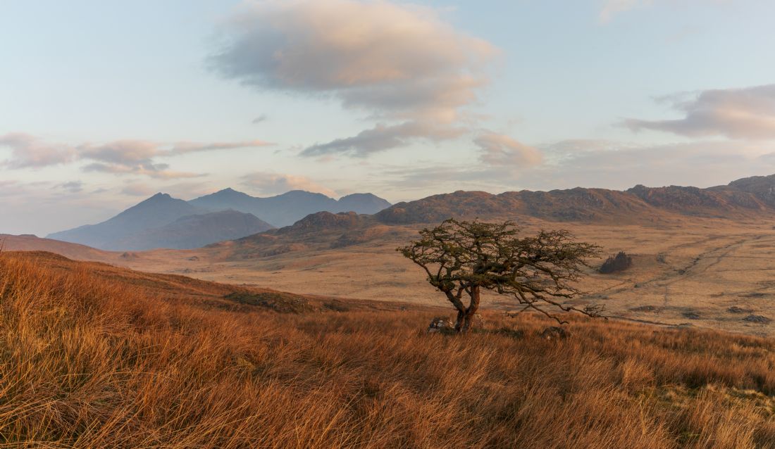
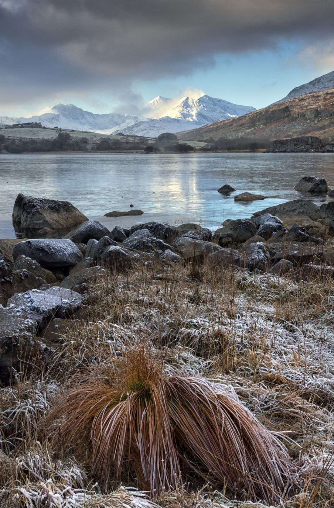
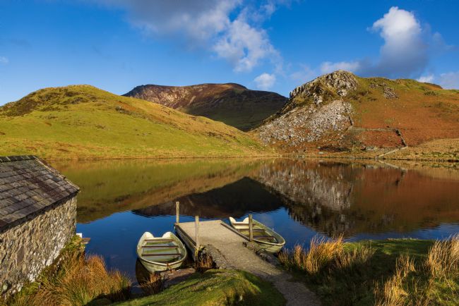
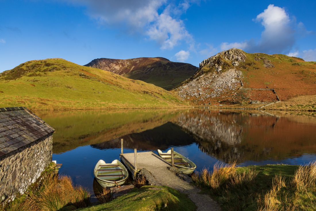
A small fishing lake located in the Nantlle valley within the Snowdonia National Park
Cwm Idwal is a cirque (or corrie) in the Glyderau range of mountains in northern Snowdonia, the national park in the mountainous region of North Wales. Its main interest is to hill walkers and rock climbers, but it is also of interest to geologists and naturalists, given its combination of altitude (relatively high in UK terms), aspect (north-facing) and terrain (mountainous and rocky). In a 2005 poll conducted by Radio Times, Cwm Idwal was ranked the 7th greatest natural wonder in Britain.
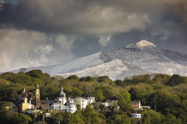
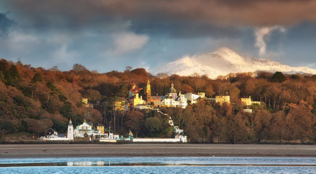
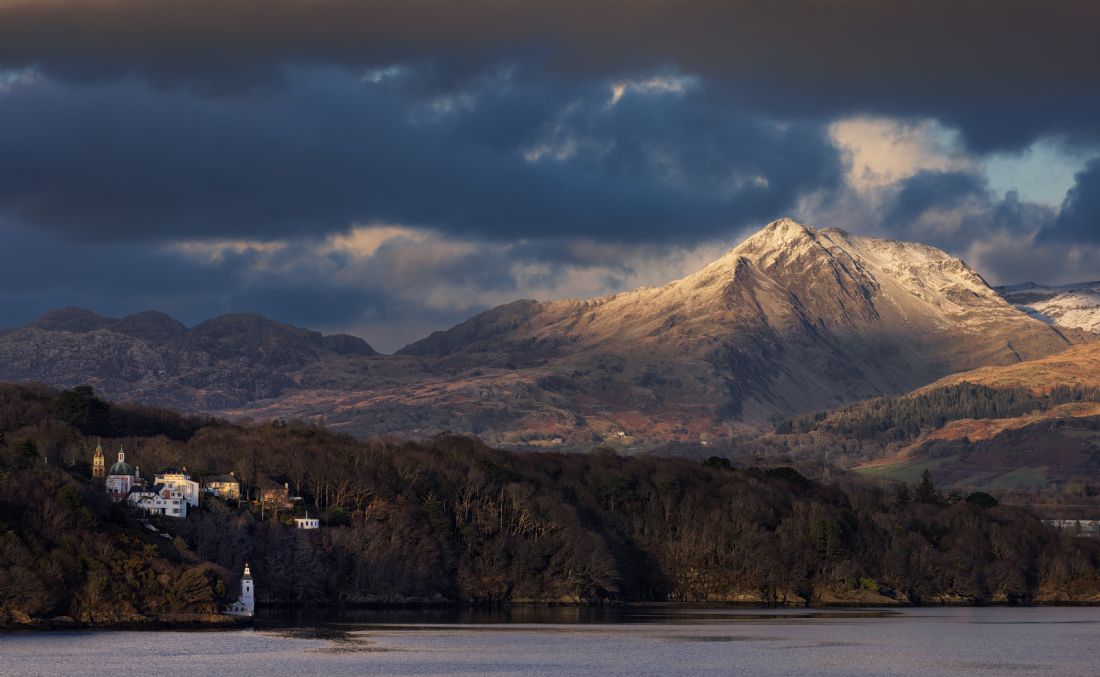
An early spring view of the Italianete village of Portmeirion. The village was designed and built by Sir Clough Williams Ellis. it is a verry popular tourist attraction in North Wales
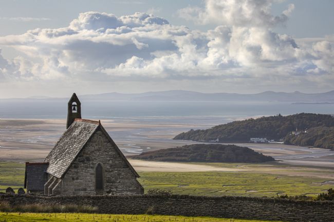
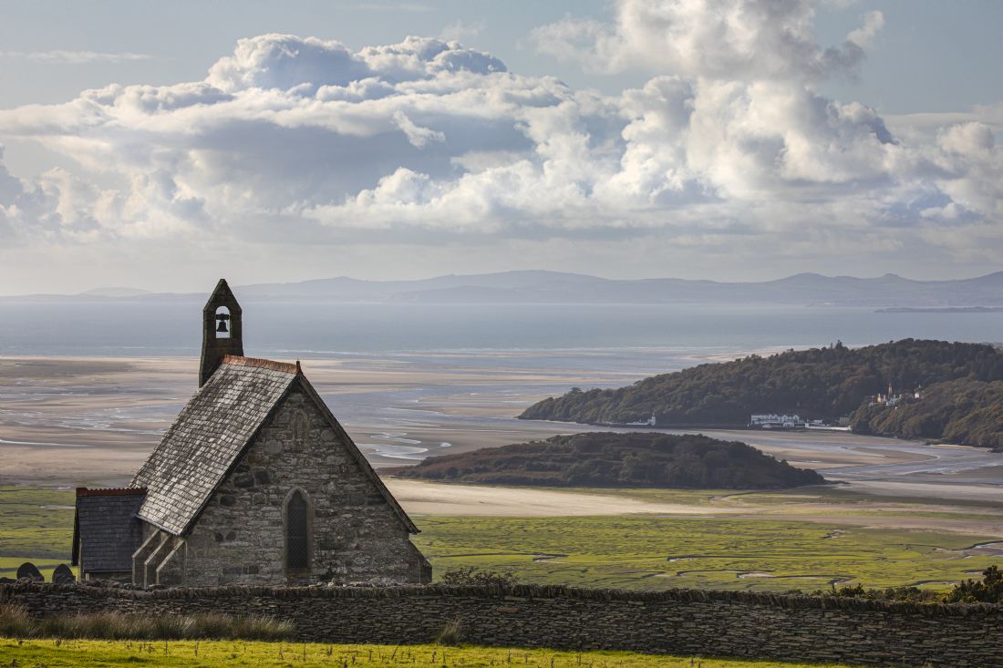
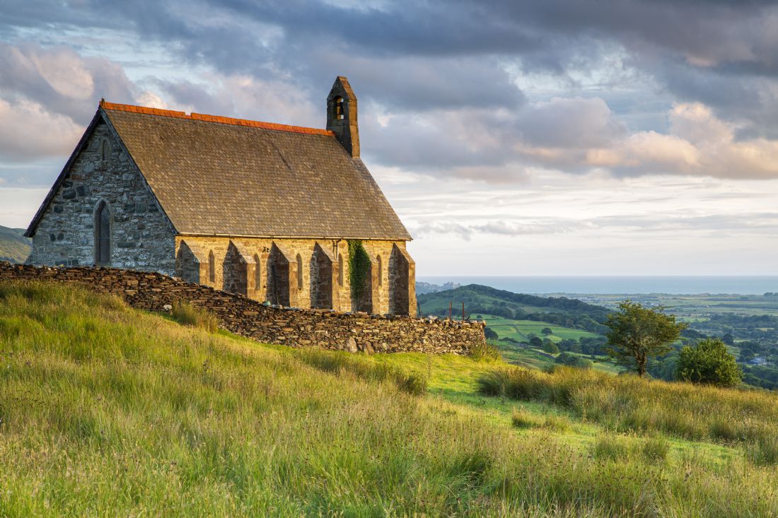
Saint Tecwyn’s church near Llandecwyn, North Wales. St Tecwyn's Church is thought to be medieval in origin. An eleventh century inscribed stone is incorporated into the present church building. The inscription has been interpreted as 'the Cross of St. Tecwyn, presbyter, to the honour of God and the most illustrious servant of God, Heli, deacon, made me. (the last word may read 'merci')'. Another medieval stone, whose pattern includes a linear Latin cross with a lozenge shaped ring at its upper end, is one of only four definite examples in Wales.
Packhorse bridge near Maentwrog - Believed to be an eighteenth century or earlier bridge crossing the Afon Prysor that carried the packhorse route between Harlech and Maentwrog
At Maentwrog the Dwyryd becomes a long and sandy tidal estuary, flowing under the road and railway line at Pont Briwet, before joining with the estuary of the River Glaslyn and then entering into Porthmadog Bay. The Afon y Glyn which drains the south west catchment from Llyn Tecwyn Uchaf and Llyn Tecwyn Isaf enters the southern side of the Glaslyn estuary at the south end of a large extent of salt marsh known as Glastraeth (green beach) on its south bank and opposite the village of Portmeirion.
A view from the Manod incline at Blaenau Ffestiniog towards Snowdon.
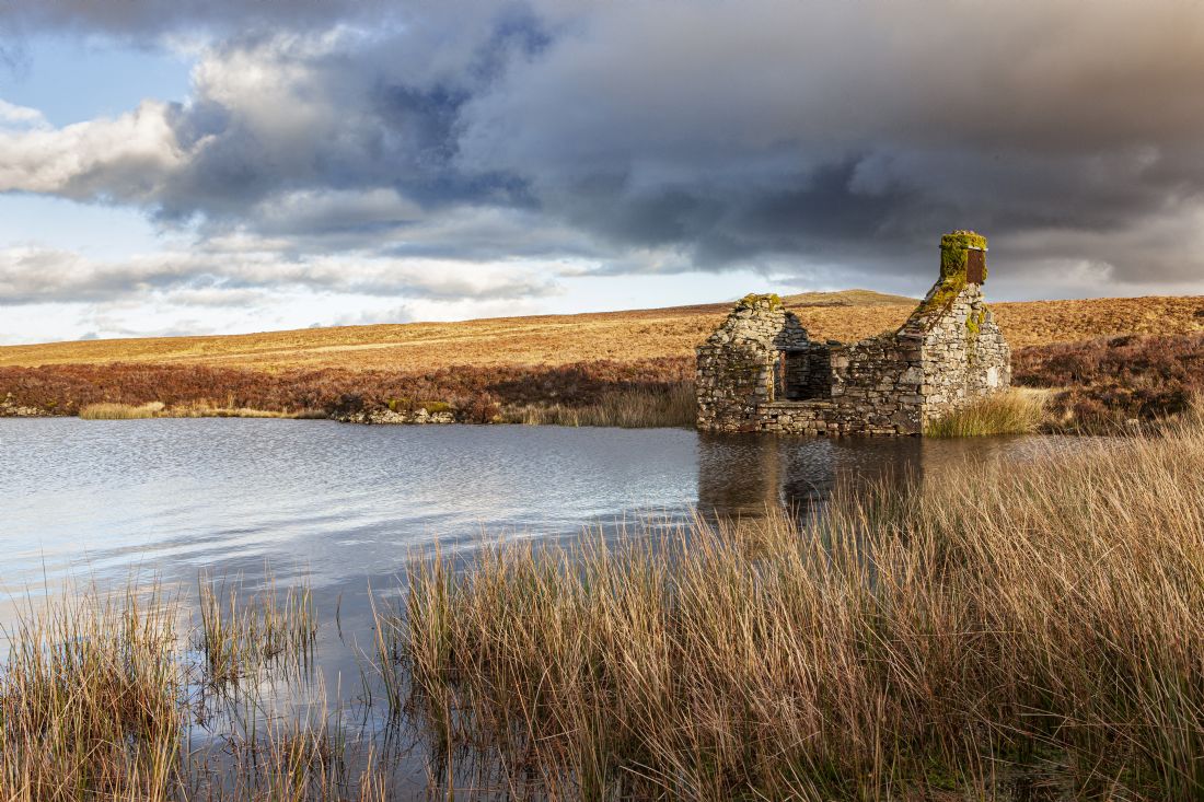
The abandoned lake keepers house at Llyn Conwy, North Wales
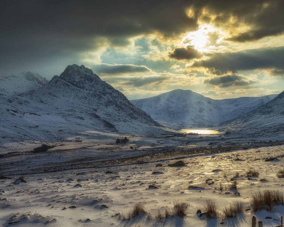
A view of Tryfan at dawn mid winter from Moel Penamnen.
A mid winter scene at Llynnau Mymbyr with Snowdon reflected in the flat calm water.
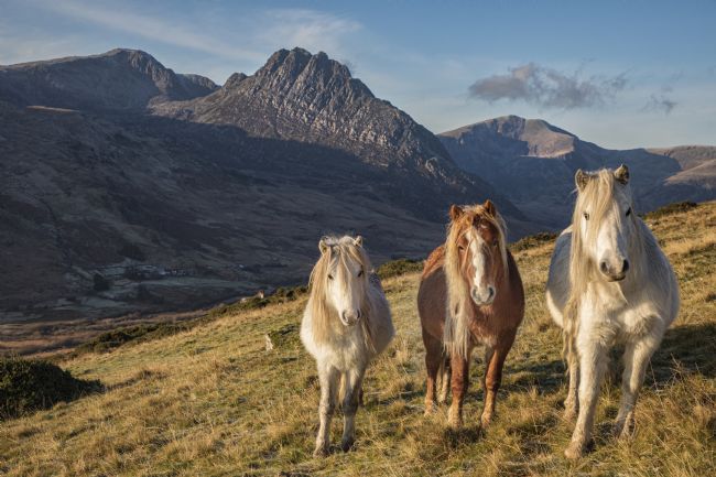
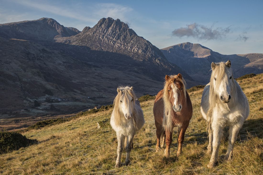
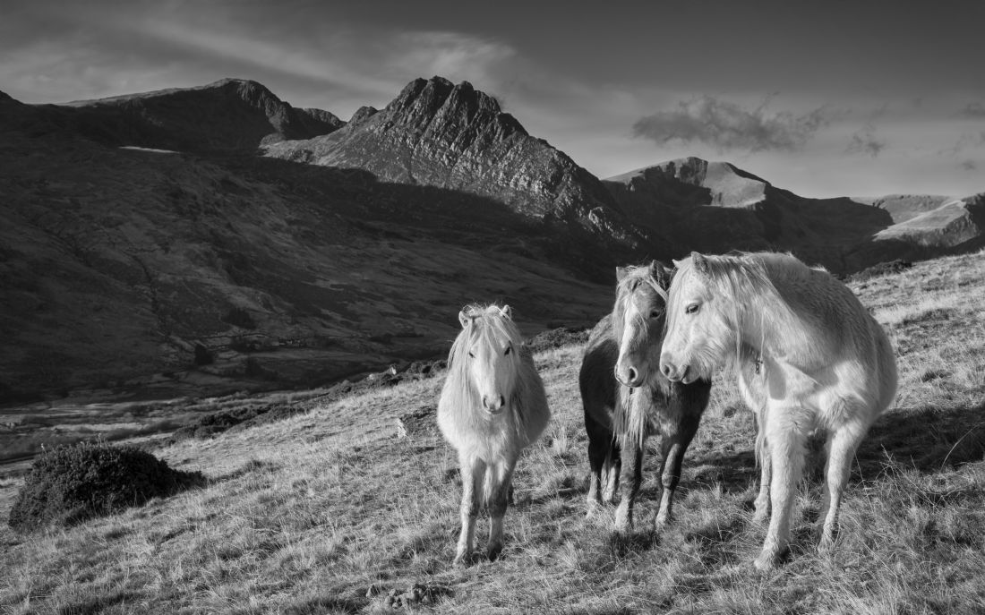
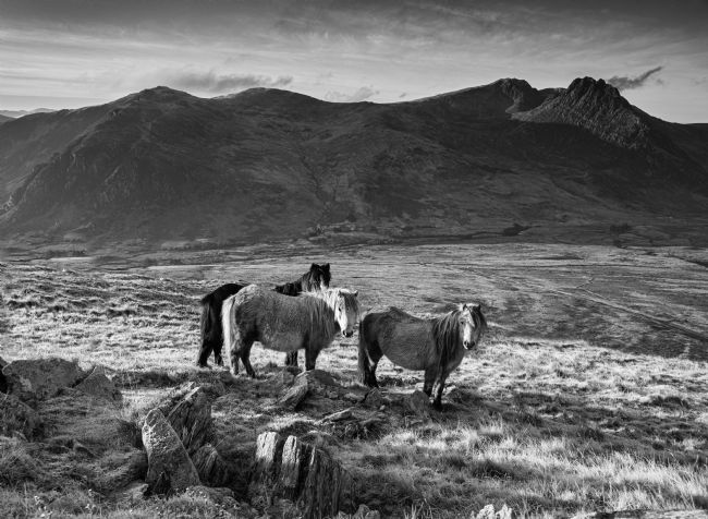
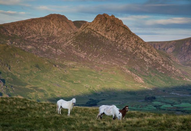
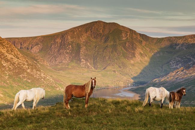
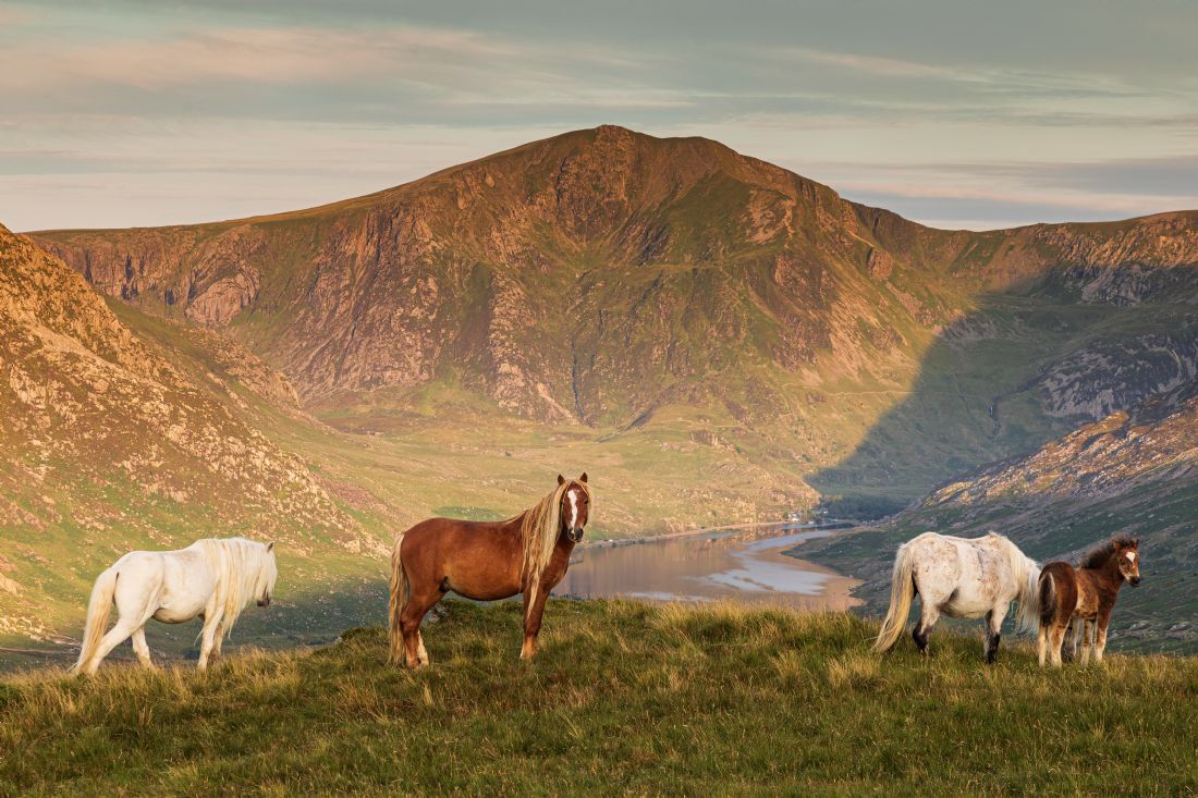
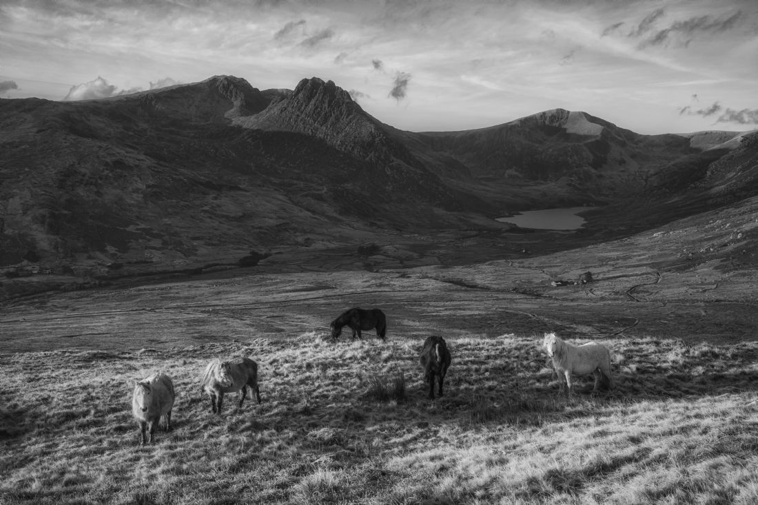
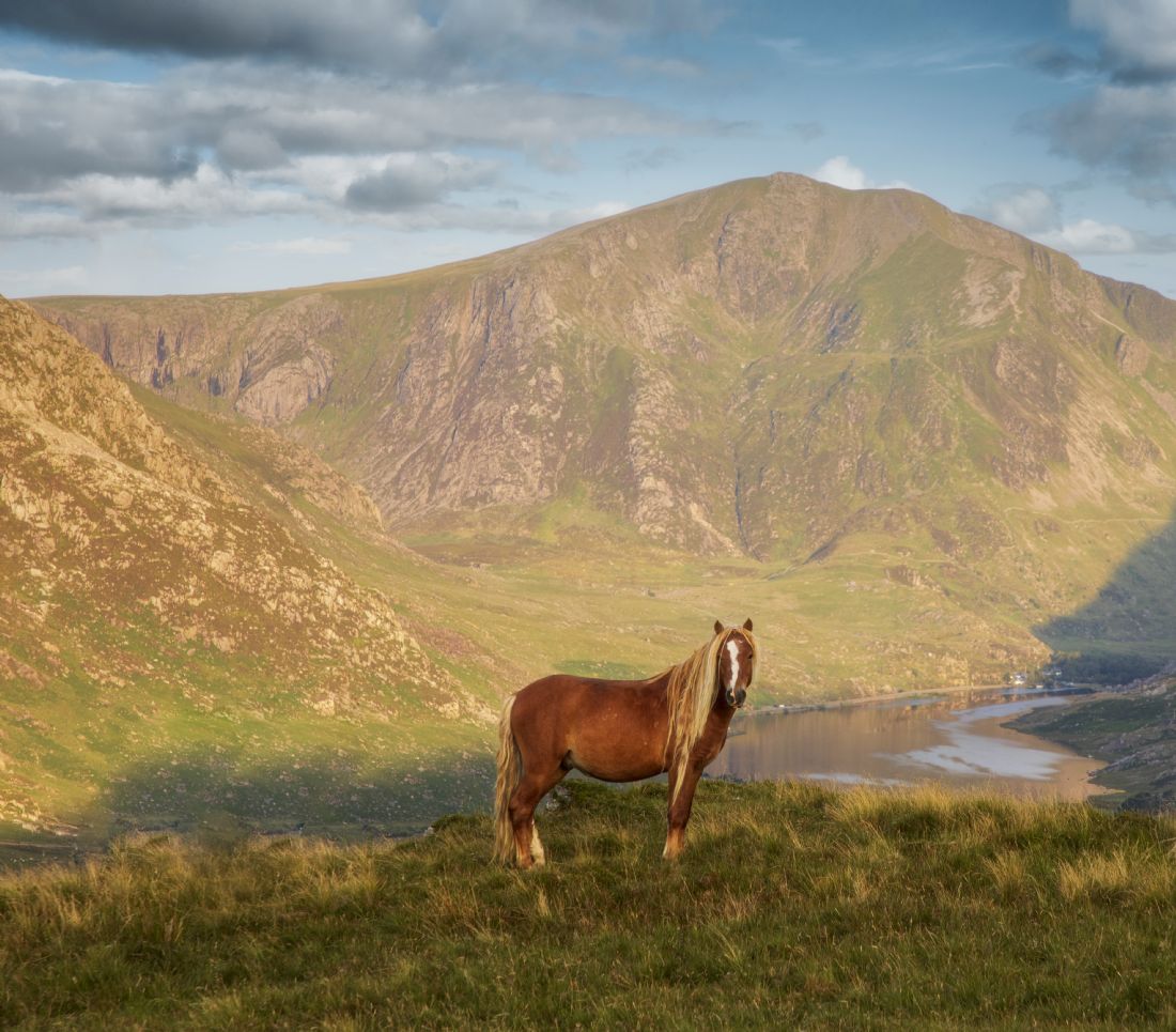
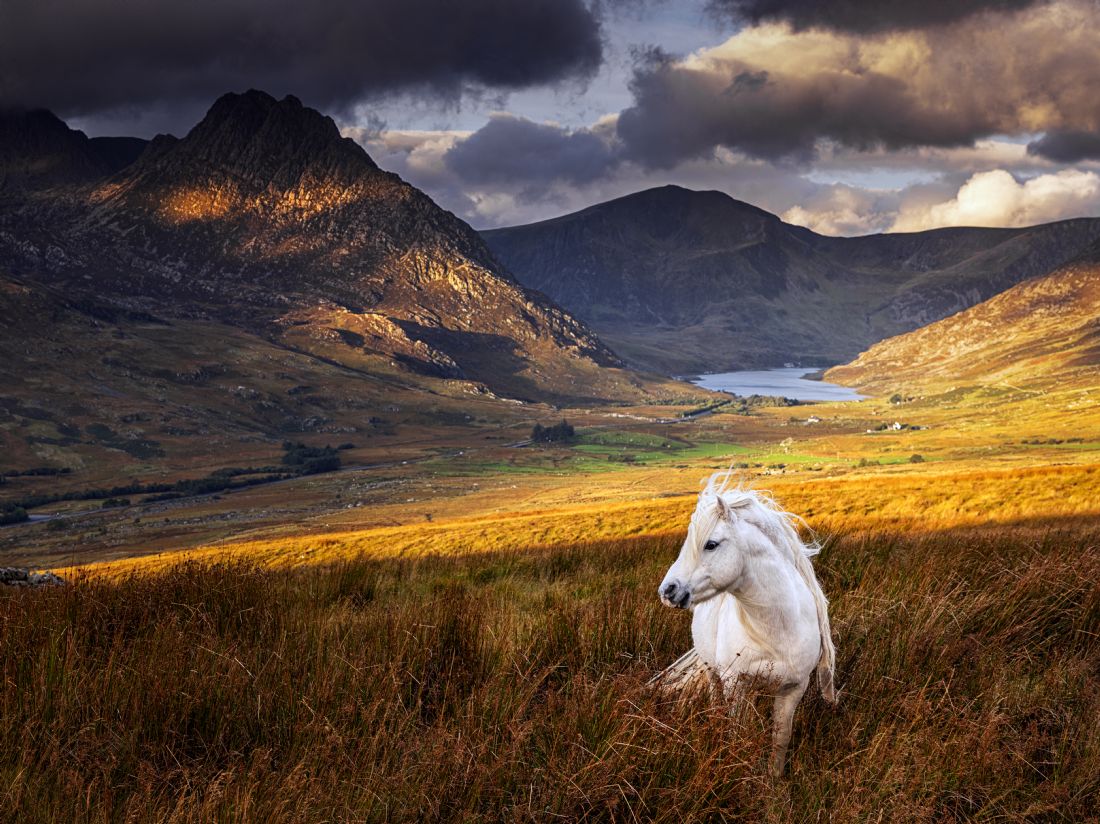
The wild ponies of the Carneddau mountain range. The Carneddau Mountain range in the Snowdonia National Park is home to a small population of around 300 semi-feral Carneddau ponies whose history is thought to date back to the Bronze Age. Although they are not designated as a rare breed, they are genetically distinct from the Welsh Mountain pony and carry genes specifically related to hardiness and waterproofing
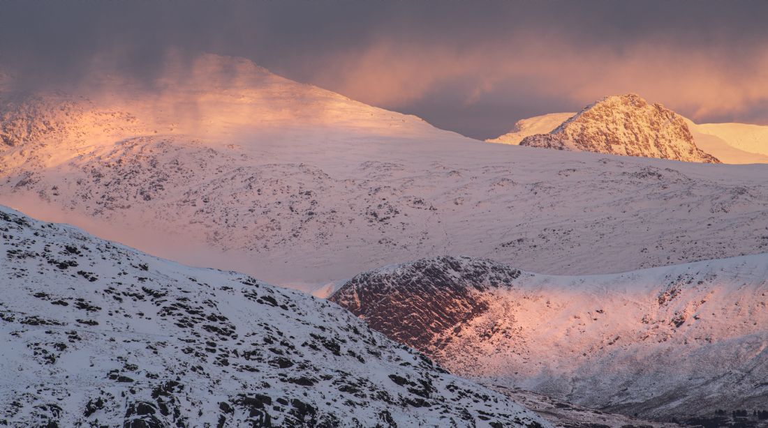
A very late cold snap . This was as a result of the Beast from the east March 2013
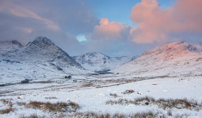
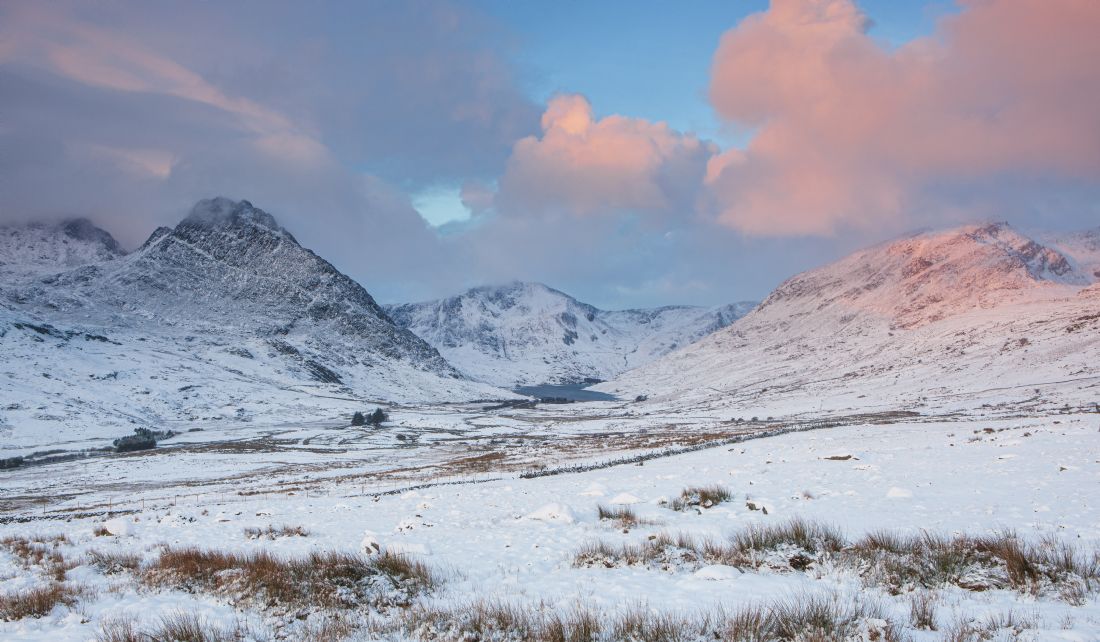
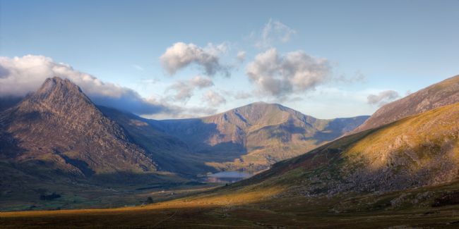
The valley lies to the south of Bangor. It is bordered one side by the Glyderau mountain range and on the other by the Carneddau. The River Ogwen (Afon Ogwen in Welsh) flows through it, separating the two mountain ranges. The valley is a part of Snowdonia National Park.
The valley was historically dependent on the roofing slate industry and it suffered from its decline from the 1960s onward. The only other significant source of employment was and still is mountain sheep farming. Unemployment is currently around 20%
Bala Lake also known as Lake Bala and by the Welsh: Llyn Tegid s a lake in Gwynedd, Wales. The name Tegid may be related to Welsh teg, meaning fair. It was the largest natural body of water in Wales before its level was raised by Thomas Telford to help support the flow of the Ellesmere Canal. It is 3.7 miles (6.0 km) long by 0.5 miles (0.8 km) wide. The River Dee runs through it and the waters of the lake are deep and clear. The town of Bala sits at its north-eastern end and the narrow gauge Bala Lake Railway runs for 3 miles (4.8 km) along the lake's south-eastern shore, and continues south-westward to the village of Llanuwchllyn whose name means church above the lake
Bala Lake also known as Lake Bala and by the Welsh: Llyn Tegid s a lake in Gwynedd, Wales. The name Tegid may be related to Welsh teg, meaning fair. It was the largest natural body of water in Wales before its level was raised by Thomas Telford to help support the flow of the Ellesmere Canal. It is 3.7 miles (6.0 km) long by 0.5 miles (0.8 km) wide. The River Dee runs through it and the waters of the lake are deep and clear. The town of Bala sits at its north-eastern end and the narrow gauge Bala Lake Railway runs for 3 miles (4.8 km) along the lake's south-eastern shore, and continues south-westward to the village of Llanuwchllyn whose name means church above the lake
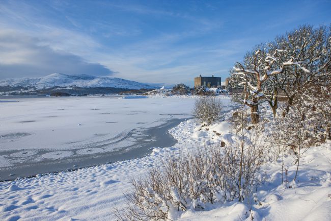
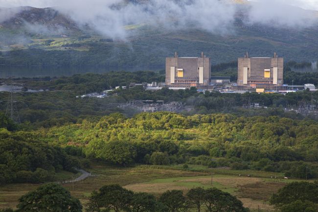
Trawsfynydd nuclear power station in the grip of winter
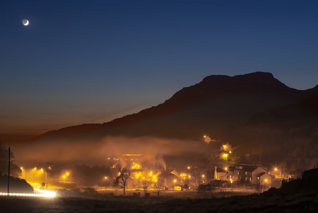
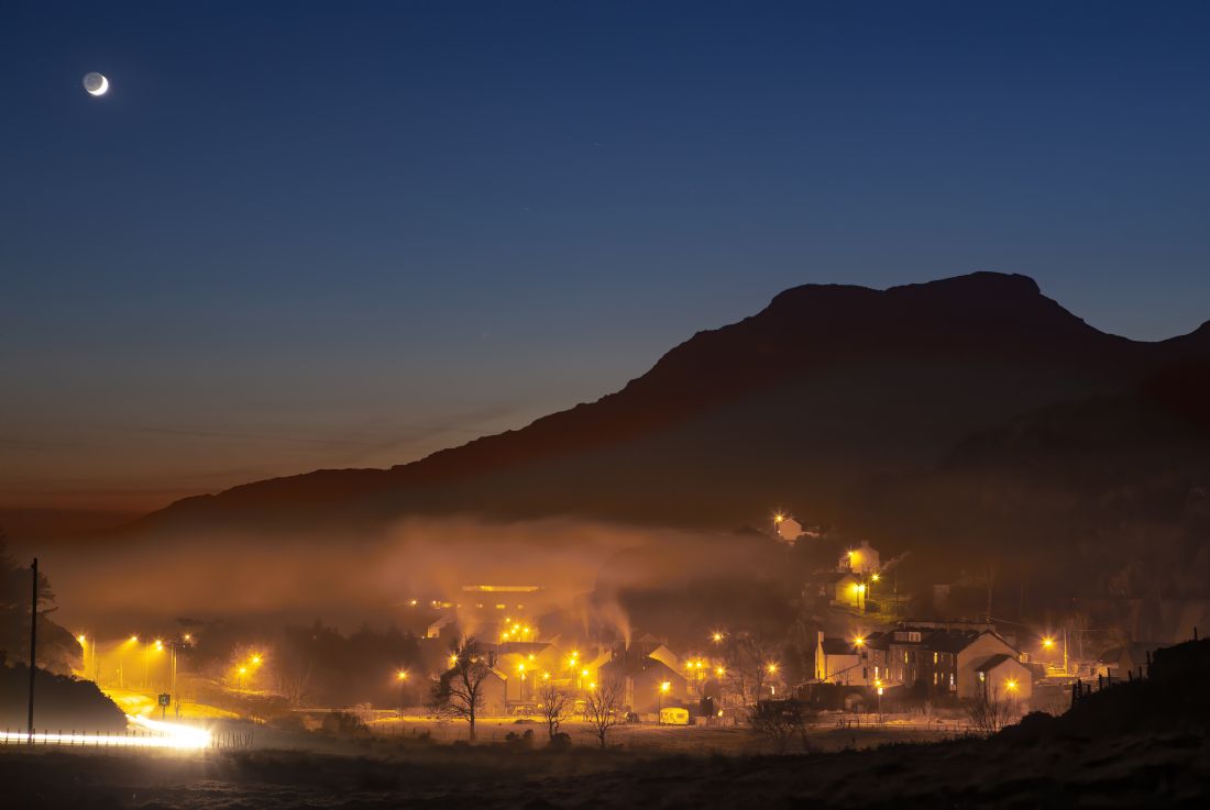
A night view of Tanygrisiau and Moelwyn bach
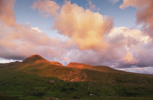
A mid summer early morning view of Moelwyn Bach.
Trawsfynydd a former Magnox Nuclear power station now in the process of being decommissioned
Site Description St Tecwyn's Church is thought to be medieval in origin. An eleventh century inscribed stone is incorporated into the present church building. The inscription has been interpreted as 'the Cross of St. Tecwyn, presbyter, to the honour of God and the most illustrious servant of God, Heli, deacon, made me. (the last word may read 'merci')'. Another medieval stone, whose pattern includes a linear Latin cross with a lozenge shaped ring at its upper end, is one of only four definite examples in Wales.
St Tecwyn's Church is thought to be medieval in origin. An eleventh century inscribed stone is incorporated into the present church building. The inscription has been interpreted as 'the Cross of St. Tecwyn, presbyter, to the honour of God and the most illustrious servant of God, Heli, deacon, made me. (the last word may read 'merci')'. Another medieval stone, whose pattern includes a linear Latin cross with a lozenge shaped ring at its upper end, is one of only four definite examples in Wales.
A small mountain stream from Llyn Bochlwyd to Llyn Ogwen. The mountain in the background is Tryfan.
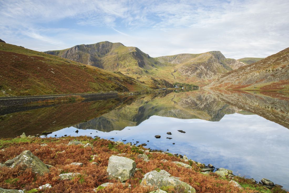
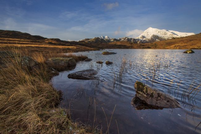
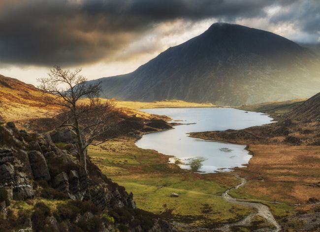
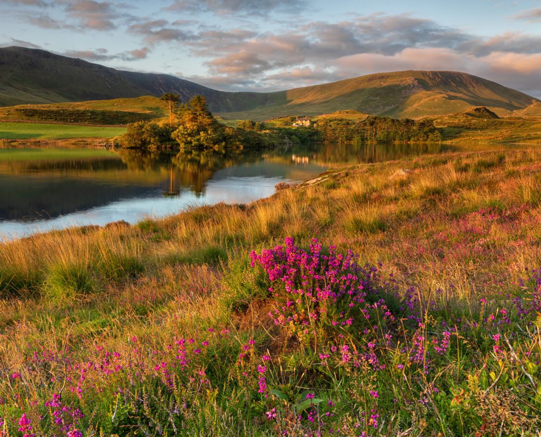
Dramatic Llyn Ogwen, one of the most popular lakes in Wales, is situated south of Bangor, and lies between the two mountain ranges of the Carneddau and the Glyderau. It stands at the head of the Nant Ffrancon Valley approx. four miles from the village of Bethesda. The lake is surrounded by high mountains, including Pen yr Ole Wen and Tryfan, considered to be one of the finest mountains in Wales. Ogwen is an extremely shallow lake, with a depth of only three metres, and is around a mile long. It lies at a height of 310 metres above sea level. The lake is the source of the River Ogwen.
The valley lies to the south of Bangor. It is bordered one side by the Glyderau mountain range and on the other by the Carneddau. The River Ogwen (Afon Ogwen in Welsh) flows through it, separating the two mountain ranges. The valley is a part of Snowdonia National Park.
The valley was historically dependent on the roofing slate industry and it suffered from its decline from the 1960s onward. The only other significant source of employment was and still is mountain sheep farming.
The valley lies to the south of Bangor. It is bordered one side by the Glyderau mountain range and on the other by the Carneddau. The River Ogwen (Afon Ogwen in Welsh) flows through it, separating the two mountain ranges. The valley is a part of Snowdonia National Park.
The valley was historically dependent on the roofing slate industry and it suffered from its decline from the 1960s onward. The only other significant source of employment was and still is mountain sheep farming. Unemployment is currently around 20%.
They are slightly smaller than the Section A Welsh Mountain (a more widely spread breed pony) standing at around 10 to 11 hands high, with a sturdy body, small ears shaped like sage leaves and big personalities!
The Carneddau herd ranges over nearly 13,500 acres or 20 square miles of common between Bethesda, Llanfairfechan, Capel Curig and Conwy, which includes mountains over 3,000 feet high, bogs, cliffs, rocky slopes and lakes. The scenery is spectacular and the ponies know every inch of it. They are owned and managed by the Carneddau Pony Society - a group of farmers from Bethesda and Llanfairfechan who are supported through a management agreement with Natural Resources Wales that helps them to maintain the herd, grazing to benefit wildlife on the mountains, from Chough to Dung beetles.
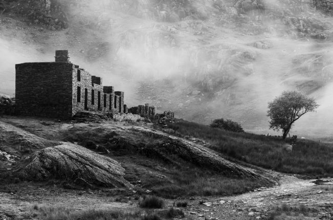
A view of the remains of the chapel at Cwmorthin near Blaenau Ffestiniog
An early morning view of llyn Dinas near Beddgelert. It takes its name from the nearby Dinas Emrys, a rocky and wooded hill just downstream of the lake where the remains of both medieval and older fortifications have been found. A rock near the lake named Carreg yr Eryr (The stone of the eagle) was said in a charter of 1198 to mark the spot where the boundaries of the three cantrefs of Aberconwy, Ardudwy and Arfon met. According to Giraldus Cambrensis an eagle used to perch on it once a week, anticipating battle between the men of the three cantrefs.
A view of Pen Llithrig y Wrach from Y Rowen above Dolwyddelan
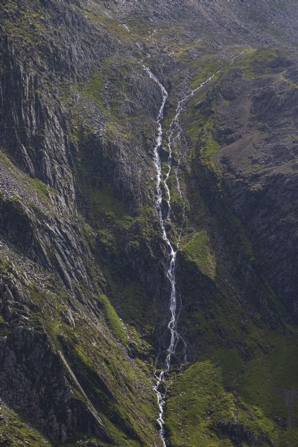
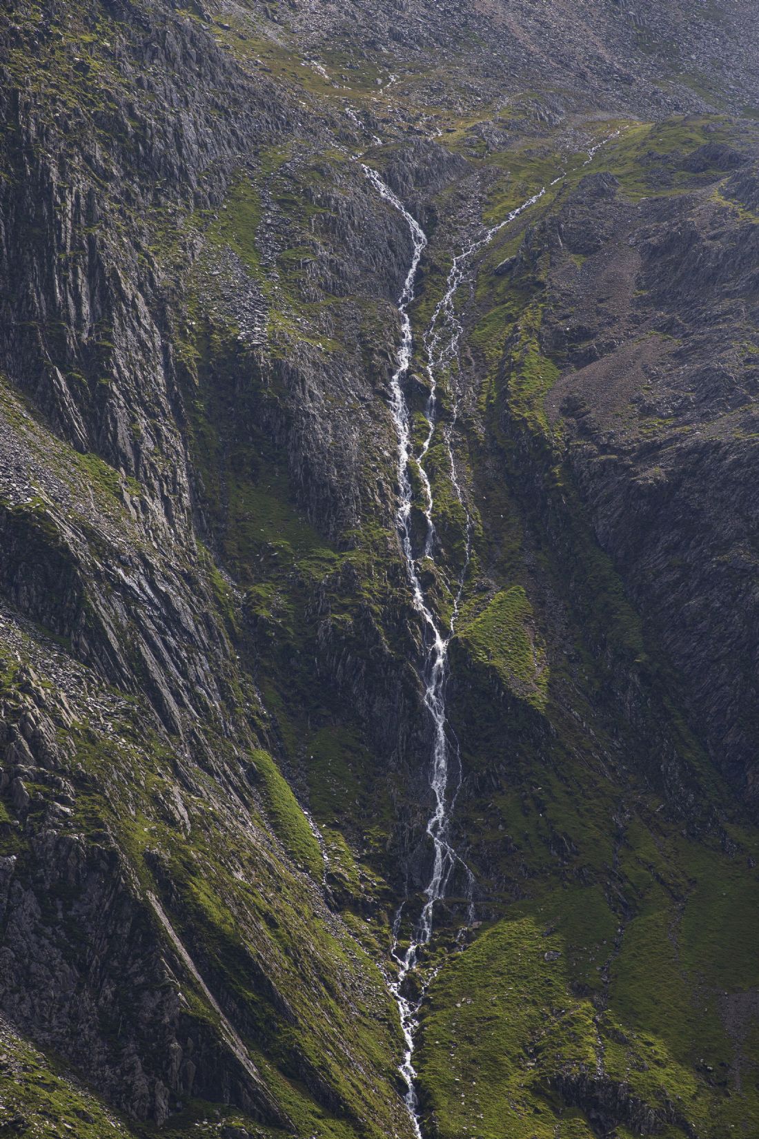
One of the many streams that fall into Llyn Idwal in the Ogswen valley
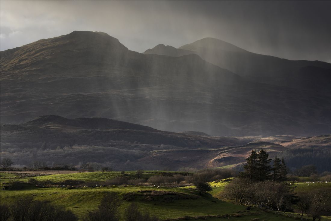
A shower of rain over the Moelwyn range
The Carneddau Ponies have been grazing the remote and rugged mountain grasslands of Snowdonia for centuries. The horses were saved from a mass cull by Henry VIII 400 years ago after he declared they must be destroyed, as they couldn't carry a knight in full armour.
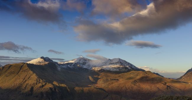
A winter scene of Snowdon at dawn
A view of Snowdon from Llyn Cwmffynnon
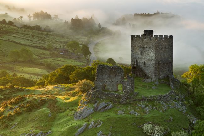
A mid summer view of Dolwyddelan castle at dawn
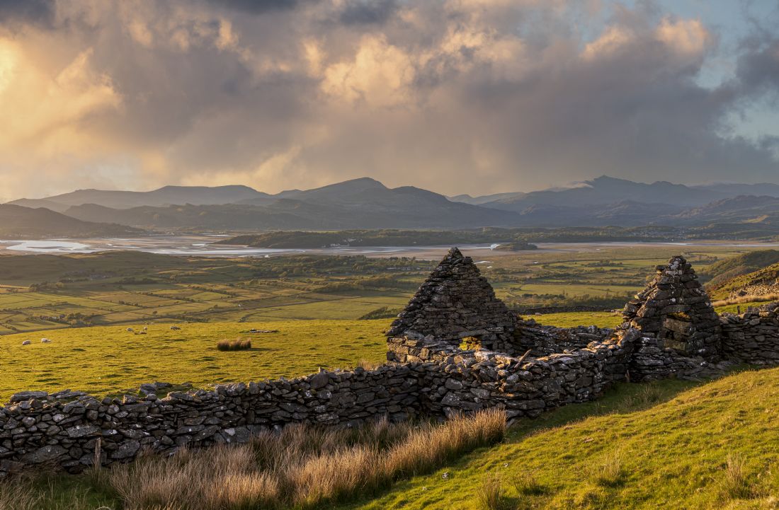
A storm passing the abandoned farmouse at Bryn Eithin. The house was sadly abandoned in 1927. There are still a couple of distant relatives living locally
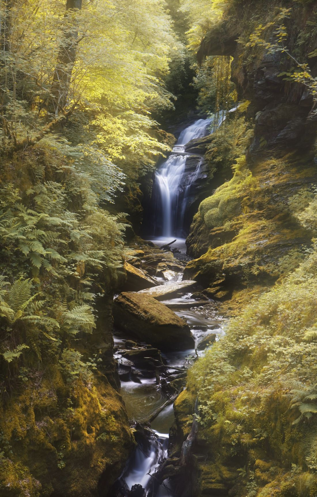
A wooded area called Coed Cymerau. This waterfall is one of North Wales’s best kept secrets near Blaenau Ffestiniog.,
Cwmorthin is a substantial Victorian-era slate mine above the village of Tanygrisau, circling the slate quarrying town of Blaenau Ffestiniog. It has a long and complex history beginning in the early 1800's, with heavy underground development starting around 1860.
It was run by several different companies as a venture in its own right during the late 1800's. The earlier underground workings started at Lake Level by the Cwmorthin Slate Company Ltd, ascended upwards in the mountain ultimately for 8 floors in both the Old and Back Vein. Poor working practices and reckless engineering decisions ultimately led to a substantial collapse in 1884 and the end of that company, which failed to recover, in 1888.
A mid winter scene at Cwmorthin near Blaenau Ffestiniog
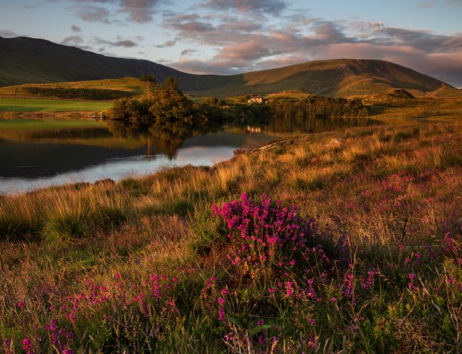
Llyn y Dywarchen is located above the village of Drws y Coed in Dyffryn Nantlle, near Rhyd Ddu. It is a very popular fishing lake, and has a car park nearby. A great location for some stargazing
A view of the sun setting against the face of Snowdon. Taken from Llyn Nantlle near Penygroes
A view of the Snowdon range from Llunnau Mymbyr near Capel Curig
This photograph give a glimpse into the lives of the mystical wild ponies that thrive on one of the UK’s most beautiful yet harsh terrains.
The Carneddau Ponies have been grazing the remote and rugged mountain grasslands of Snowdonia for centuries. The horses were saved from a mass cull by Henry VIII 400 years ago after he declared they must be destroyed, as they couldn’t carry a knight in full armour.
Today they remain part of the landscape in North Wales
Tal-y-llyn Lake is a 220 acre ribbon lake situated north-east of Tywyn and north of Machynlleth at the foot of Cadair Idris in Southern Snowdonia. the River Dysynni flows from the lake through the village of Abergynolwyn to the sea north of Tywyn on the Mid Wales coast near Tonfanau.
This beautiful lake offers superb brown trout fishing from both boat or bank and as the lake has an average depth of only 8ft floating lines can be used from the outset. The fishing season runs from April to mid October and in the later part of the season sea trout and salmon run up the river to Tal-y-Llyn, and the lake is famed for its particularly large sea trout.
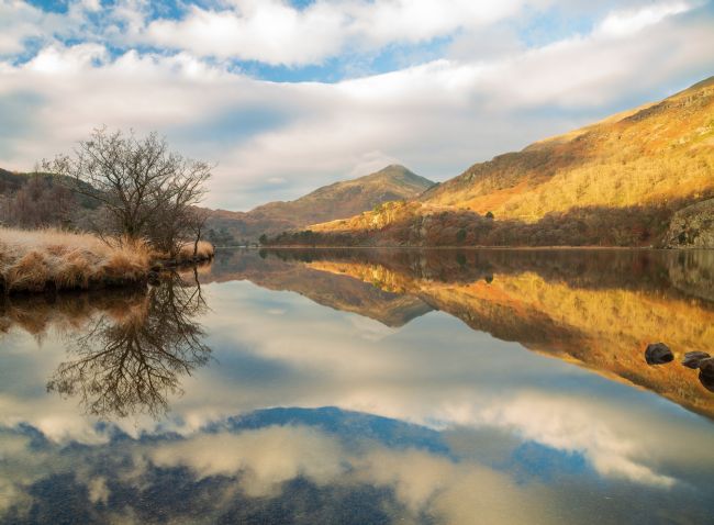
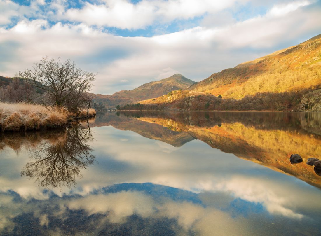
Llyn Gwynant lies on the River Glaslyn and is a lake in Snowdonia, Wales.
It is probably the most photographed lake in Snowdonia. It is a lake formed by glacial activity and as a result is relatively shallow. The most popular activities on the lake are fishing and canoeing. It’s claim to fame was that it was used as a backdrop for a Lara Croft Tombraider film called the Cradle of Life.
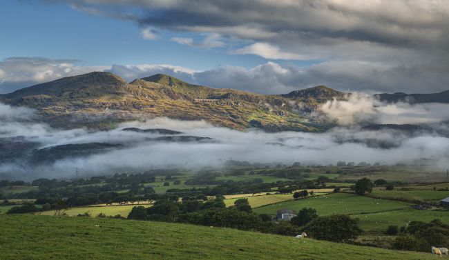
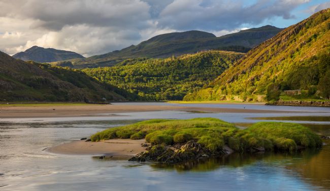
The Vale of Ffestiniog is a valley within the Snowdonia national park which streches from Ffestiniog to Tremadog bay. This is part of the river called Afon Dwyryd which runs through the valley.
An early morning scene at Llyn Cregennen in the mountains of South Snowdonia. Cregennen is a tranquil location high up and just to the east of Cader Idris.
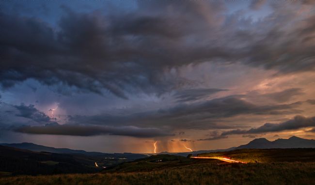
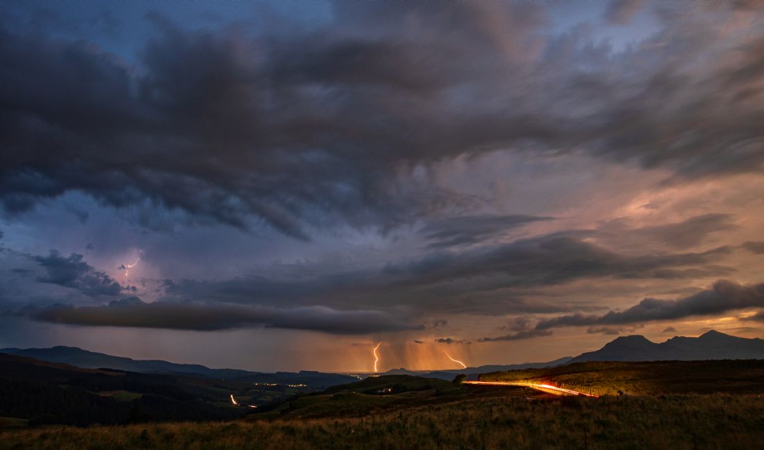
Some lightning bolts during an electrical storm over the vale of Ffestiniog.You can just make out a streak hitting the harbour at Pwllheli
A. view of Snowdon from Coed llyn y Garnedd near Maentwrog. Thanks to a recent tree felling campaign the view is now available for a few years.
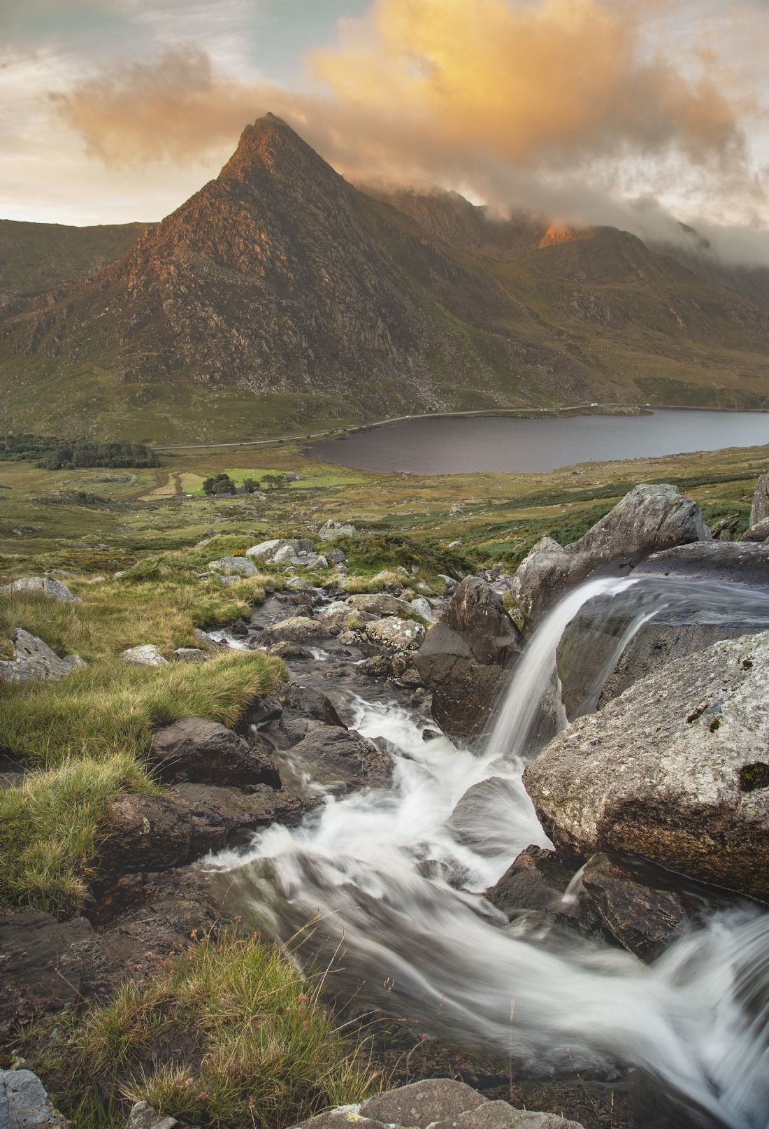
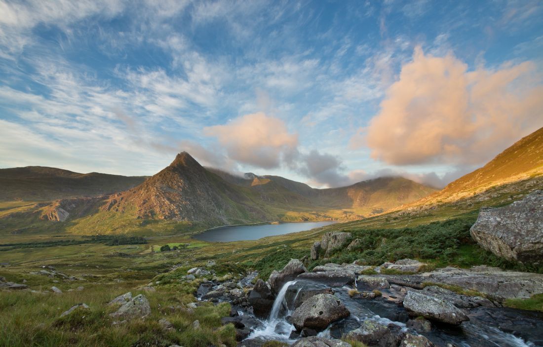
Tryfan is a mountain in the Ogwen Valley, Snowdonia, Wales. It forms part of the Glyderau group, and is one of the most famous and recognisable peaks in Britain, having a classic pointed shape with rugged crags. At 917.5 metres above sea level, it is the fifteenth-highest mountain in Wales. On the summit are two pillars of rock known as Adam and Eve. Climbers who reach the summit usually jump across from one pillar to the next.
A mid summer morning on the way down from a walk in the hills and I was fortunate enough to bump into these wild ponies. They had a foal with them so I was careful not to get too close especially as I had an over friendly labradoodle with me !
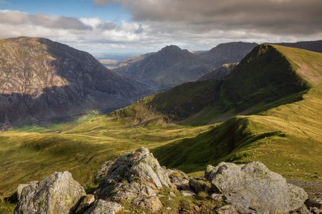
A view from Mynydd Parfedd across to Y Garn and Tryfan. The A5 can bee see meandering through the valley.
A small fishing lake in the shadow of Mount Snowdon in the Snowdonia National Park
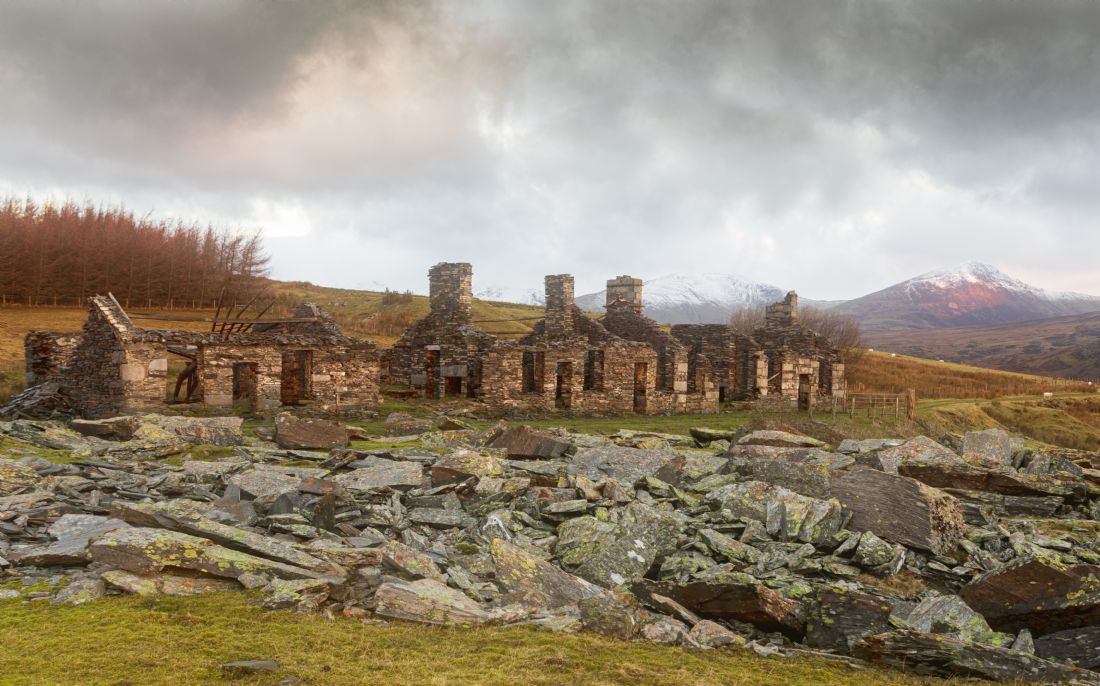
This terrace of abandoned cottages are at the foot of Moel Siabod, a mountain in the centre of the Snowdonia National Park. The quarry was there to recover slate from the north west corner of the mountain. The cottages themselves have commanding views over the A5 and towards Betws y Coed.
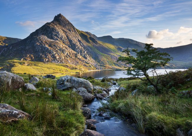
A view of the mighty tryfan on the left alongside llyn Ogwen. The valley is to the north east of the Snowdonia national park. Tryfan is one of the most popular scrammbling walks in the UK
A horseshoe valley located north of Tryfan. It is a very popular walk as it is close to the A5 trunk road. The lake is called llun Idwal. The image was taken at the foot of an area called the Devils kitchen.
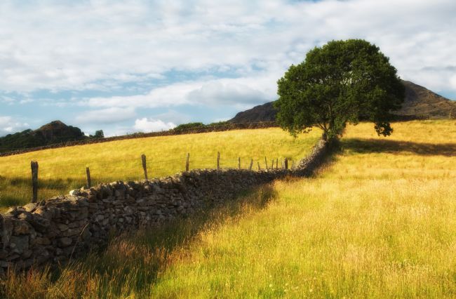
I walk past ths particular field quite often and see the are in all seasons. I was struck on this occasion as the grass appeared so vivid in the early evening light.
This was taken on the way down from witnessing a sunrise from the summit of Snowdon. The mountain to the left is called Y Lliwedd. This particular route down is called the PYG track (Pen Y Gwryd)
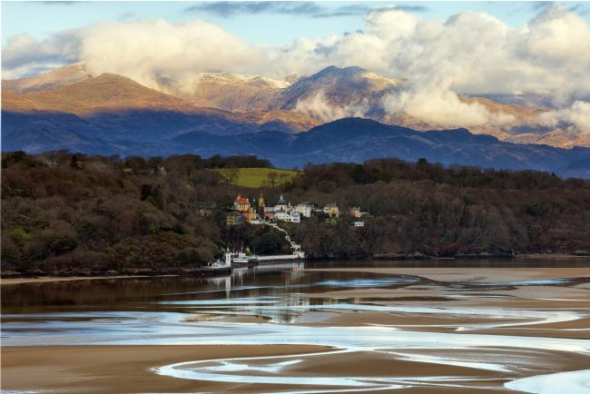
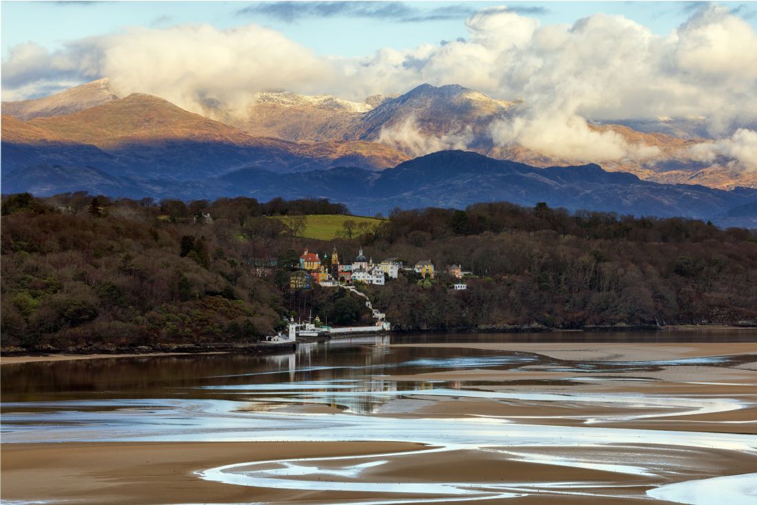
The Italianete village of Portmeirion taken from across the estuary at Ynys. Snowdon in the background with a light dusting of snow.
A rock feature which is quite prominent feature at the top of the Glyder mountain range. In the background is Snowdon, the highest mountain in Wales.
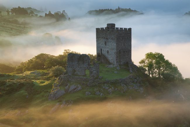
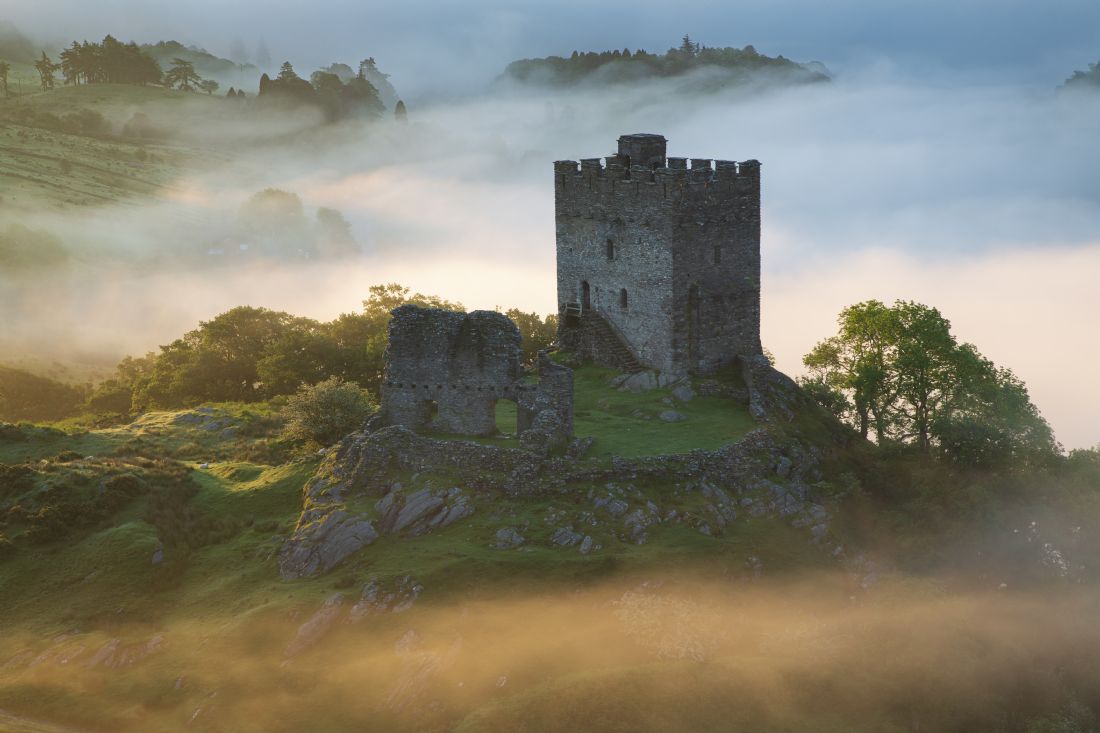
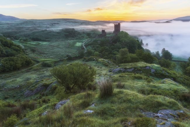
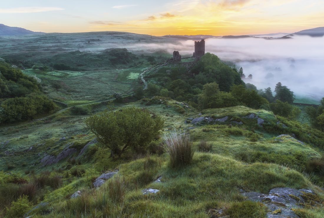
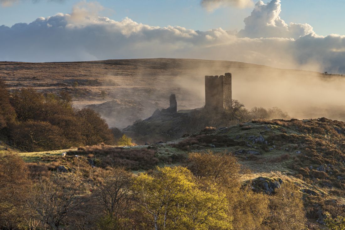
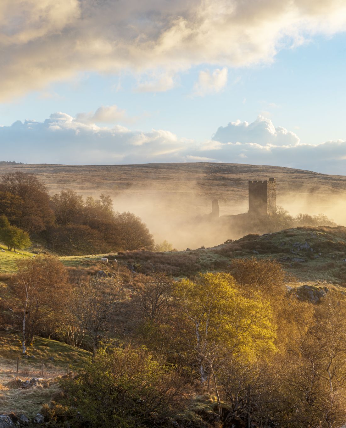
Dolwyddelan castle is quite a prominent feature tucked within the mountains and landscape of Snowdonia. One of the many castles in wales built by Llewellyn the Great. The castle fell to Edward the 1st in 1283
Taken in between Maentwrog and Blaenau Ffestiniog. The mountain in the distance is called Manod Mawr. During WW2 the contents of the National Gallery were taken and stored there.
It was great to see the Carneddau wild mountain ponies on the south west corner of the Carneddau range. These wild ponies have been roaming the mountain range for over two hundred years. Although wild there are a few local farmers who do tend to their needs occasionally bringing them food when the weather get particularly bad.
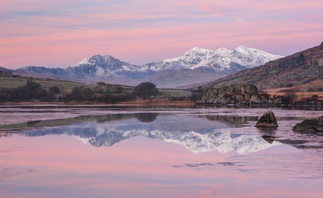
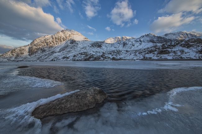
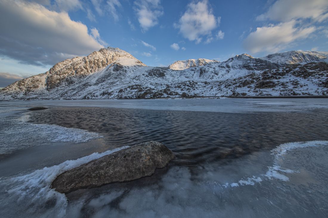
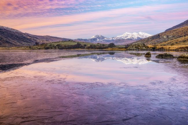
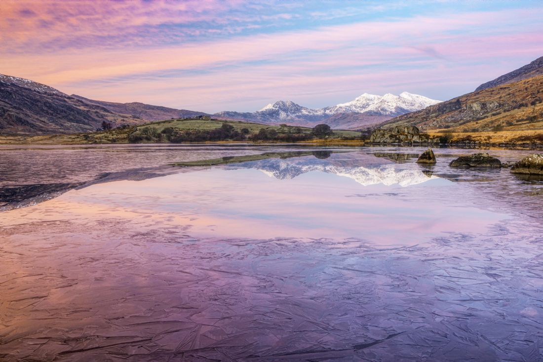
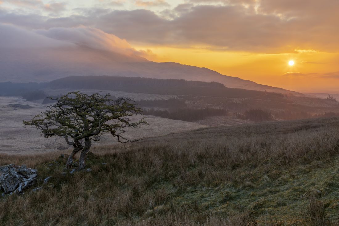
I arrived at the location around 40 minutes before sunrise. The pink colour was the sun reflecting back off the clouds. As an added bonus i managed to get the reflection in the small section of the lake where the water had not frozed over.
Nestled at the foot of the Glydyr mountain range is a valley called Cwm Idwal. Due to it’s location within the Snowdonia national park it is apopular place to visit
One of the carneddau ponies grazing above Llyn Ogwen.
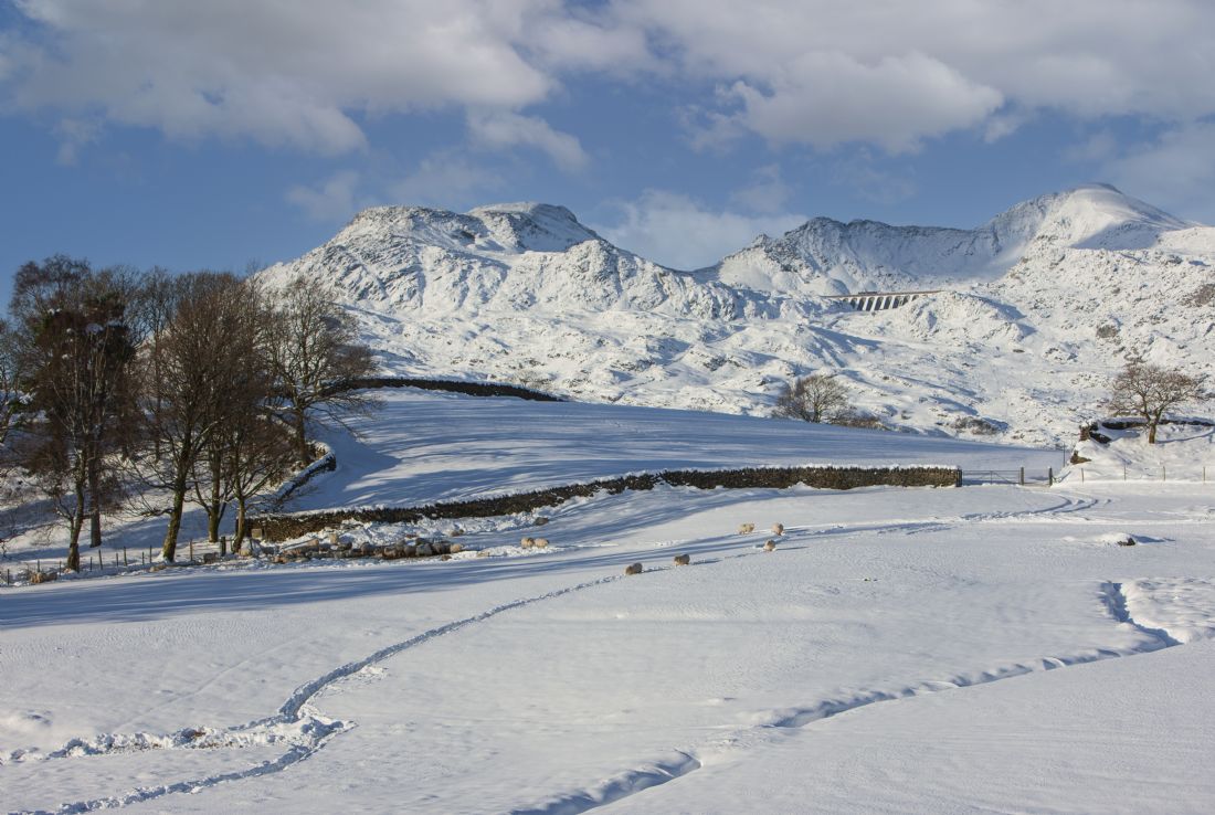
A wintery scene at Blaenau Ffestiniog after a night of heavy snow. The dam which you can see in the middle distance is called Stwlan and is part of the ffestiniog pumped storage scheme.
A view of Moel Hebog and Moel yr Ogof from Llyn Dinas in the middle of the Snowdonia national park. The ancient village of Beddgelert is nestled on the foot of Moel Hebog
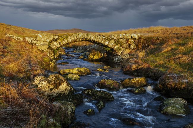
Pont Rhyd y Porthmyn - Migneint pack horse bridge. The ramains of an ancient packhorse bridge which crosses the vast boggy landscape of the Migneint.
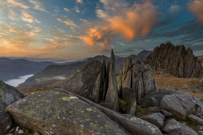
A prominent rock feature on the summit of Glydyr Fawr called castell Y Gwynt translated into castle in the wind. The views across snowdonia from the location s stunning.
An early morning view of the Snowdon range taken in December 2020
A view of Nant Gwynant in the heart of Snowdonia
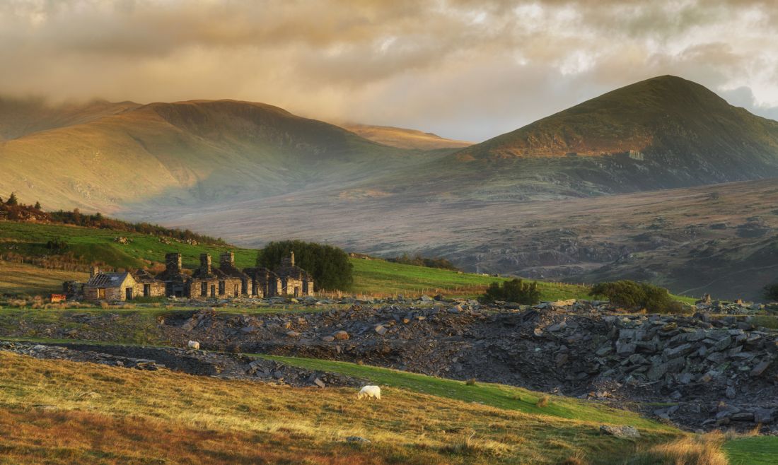
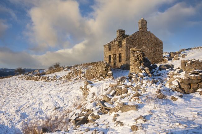
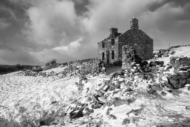
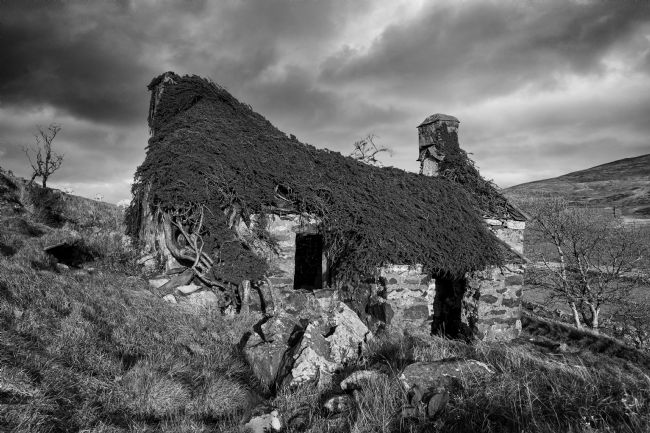
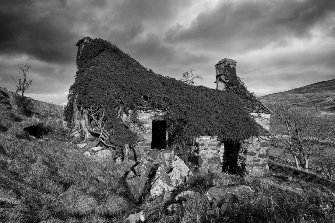
A mid winter scene of an abandoned farmhouse near Blaenau Ffestiniog. It was last occupied in 1922.
A mid winter scene of an abandoned farmhouse near Blaenau Ffestiniog. It was last occupied in 1922.
An abandoned farmhouse within the Snowdonia National Park. It is interesting to see what nature takes back and hasused the building as a support.
One of my favourite places in North Wales. I like the view and the road which runs through it. The valley seems to have it's own weather system. You could be in bright sunlight in Bangor just a few miles away and you come here and it's pouring with rain. This was an early morning trip to catch the sun on the Carneddau range to the right of the shot. The mountain on the left is called Tryfan.
Nestled at the foot of the Glydyr mountain range is a valley called Cwm Idwal. Due to it’s location within the Snowdonia national park it is apopular place to visit
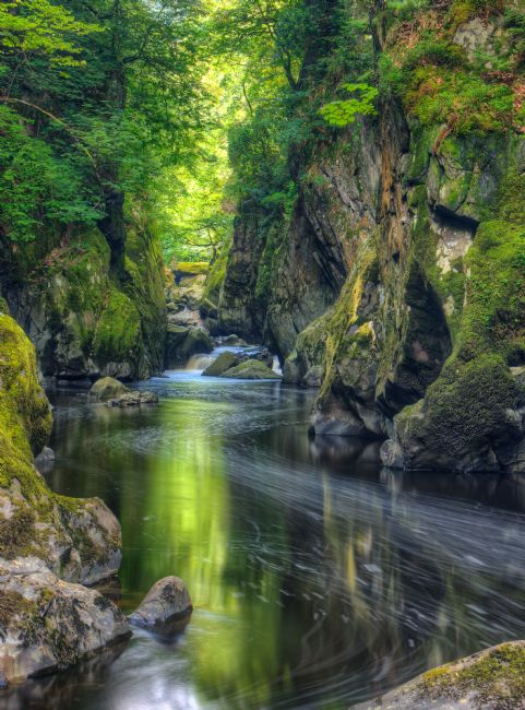
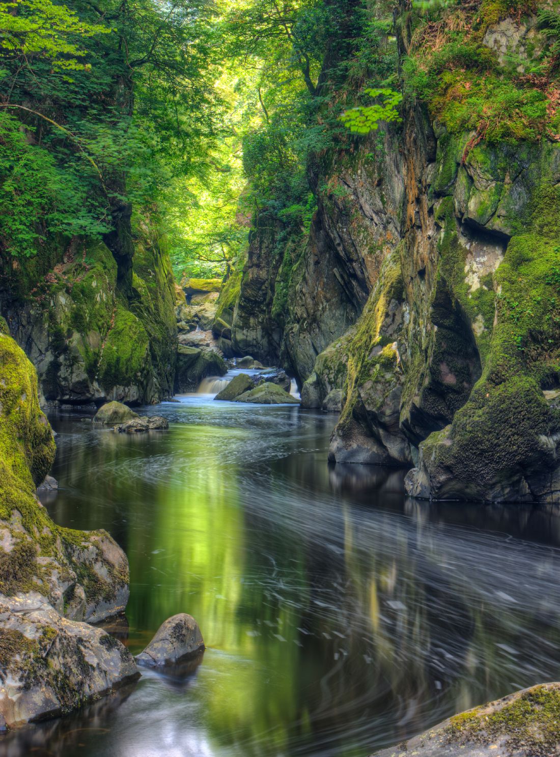
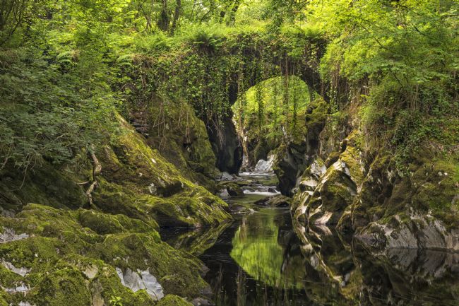
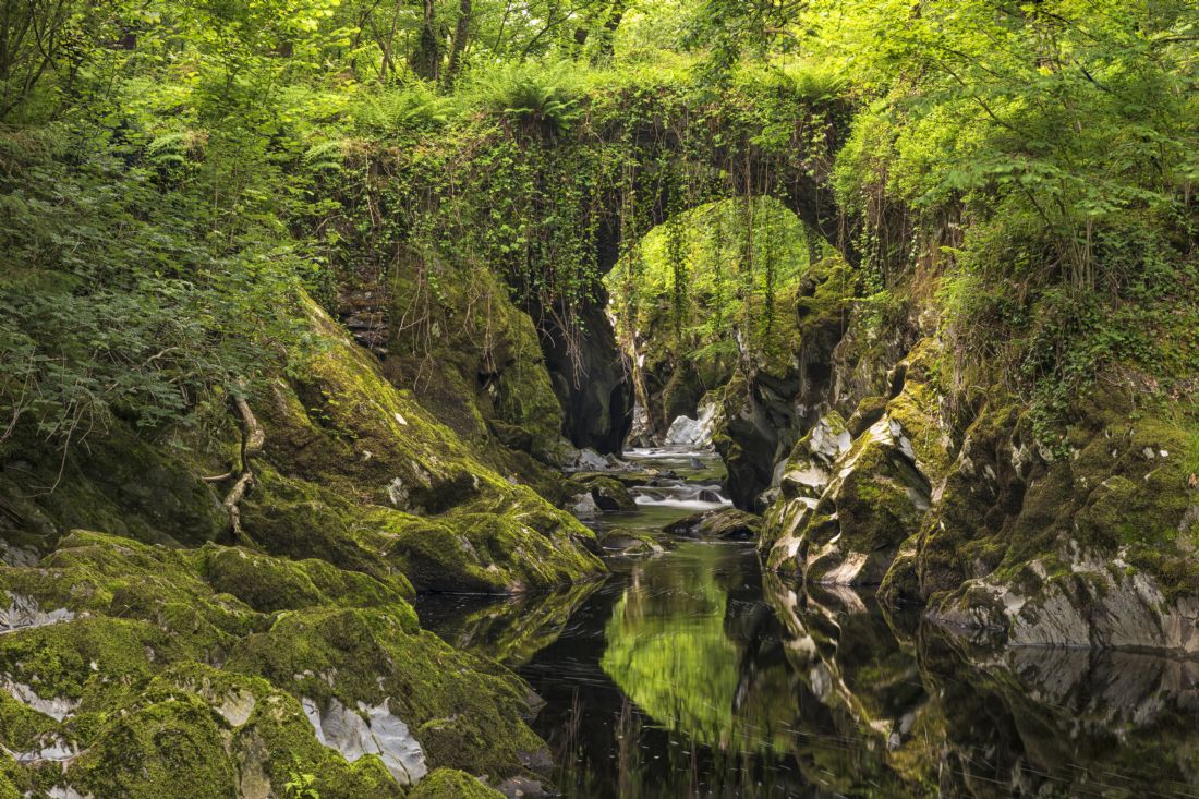
Fairy Glen is small gorge on the outskirts of Betws - y - Coed, North Wales. It is a popular tourist location. The walk to the Glen is quite nice along a wooded path. There are a few steep steps near the area so good footware is a must.
A view of Llyn Dinas from the south and also Moel Siabod can be seen in the distance on the right.
The Lledr valley near Betws y Coed with Mel Siabod mountain th the background
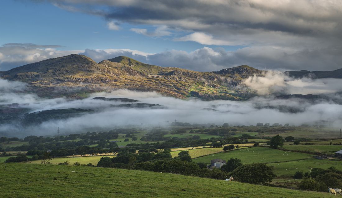
A heavy spring shower over the Vale of Ffestiniog
A very low almost in the water view of Cregennen near Dolgellau
A mid summers evening image of the Cwmorthin Quarray terrace near Blaenau Ffestiniog
A view of Moelwyn Mawr from the path leading up to Cnicht
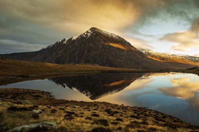
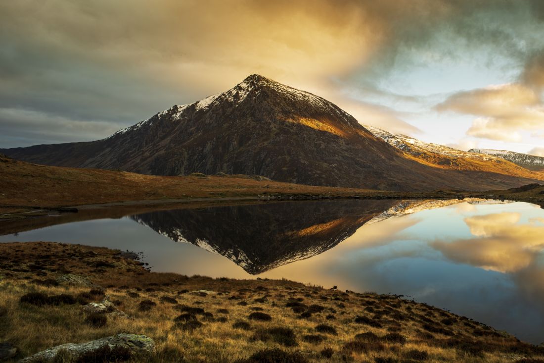
A view of Llyn Idwal during a mid winter sunrise. The mountain to the left is Pen yr Ole Wen
A reflection of Pen yr Olw Wen in the silky smooth llyn Idwal
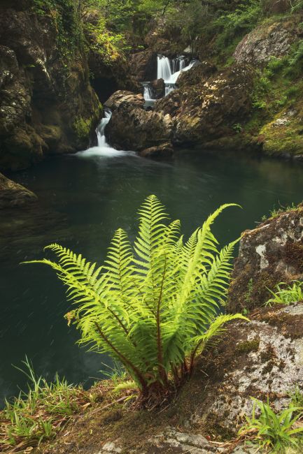
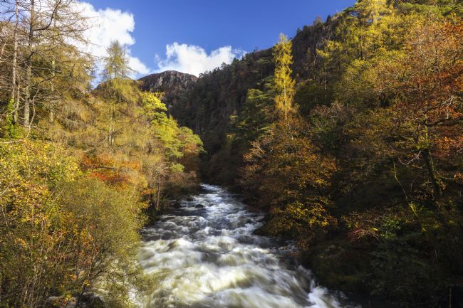
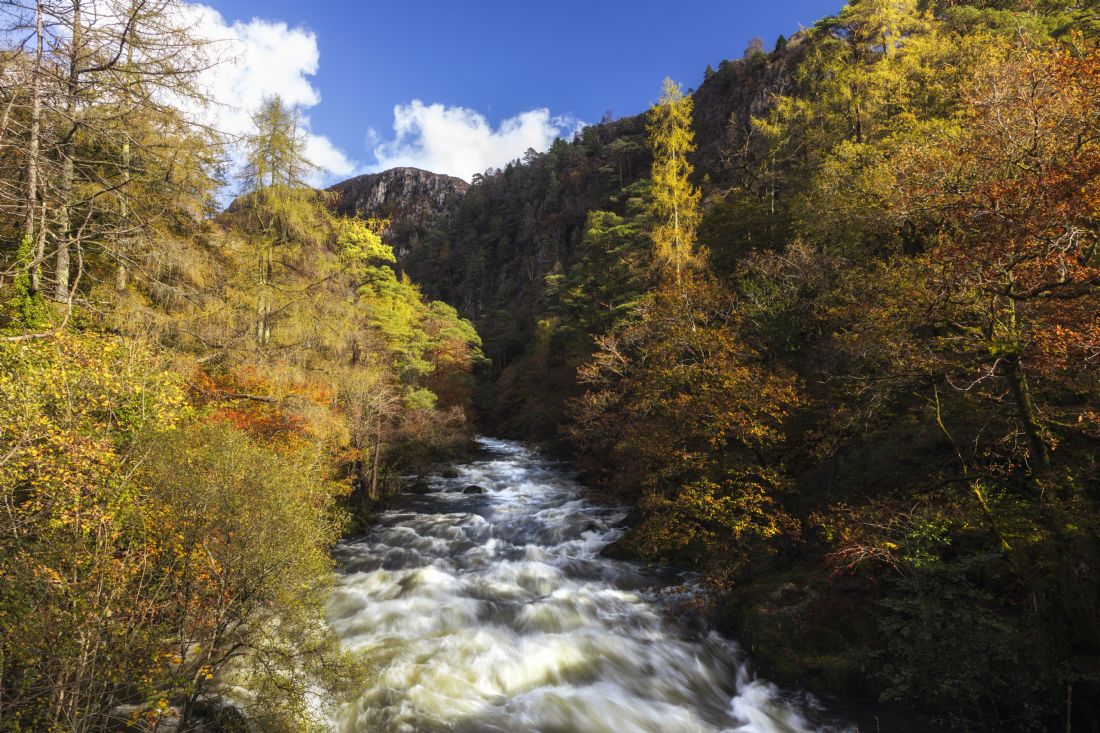
Cynfal falls near Llan Ffestiniog
Taken on the first day of May 2021 on the southern side of Moel Siabod. at Cwm Edno The Snowdon mountain is just to the left out of shot
A view of Yr Wyddfa (Snowdon) from Cwm Edno. It was a fabulous sunrise on the first day of May.
A view of Llyn Gwynant taken just off the path leading up from Nantgwynant to Roman Bridge.
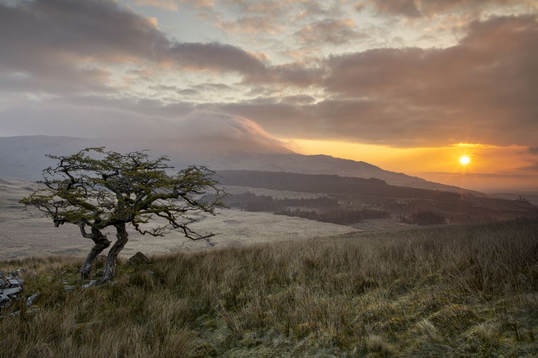
A tree at the head of Cwm Edno. To the left is moel Siabod with clouds tumbling over the summit.
One of the very few trees that grow in an often overlooked valley in Snowdonia, Cwm Edno. Yr Wyddfa or Snowdon can be seen in the background. This image was taken at dawn hence the warm feel to it.
A view of Dolwyddelan castle and Moel Siabod in the Snowdonia national Park
It was one of the coldest May mornings I have known for years. I had to spend quite a while scraping the ice off the car before setting out. Fortunately I had left the snow tyres on as there was ice on the Crimea pass ! There was some mist in the valley as I set off from the car. This slowly burnt away as the sun rose.
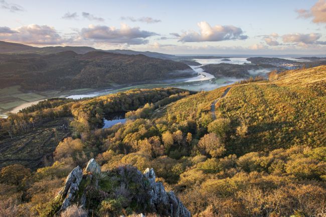
A panoramic view of the mountains of southern snowdonia. It was taken from the banks of Afon Glaslyn near the Minffordd granite quarry. In the left is Yr Wyddfa (Snowdon) and on the right is Moelwyn bach
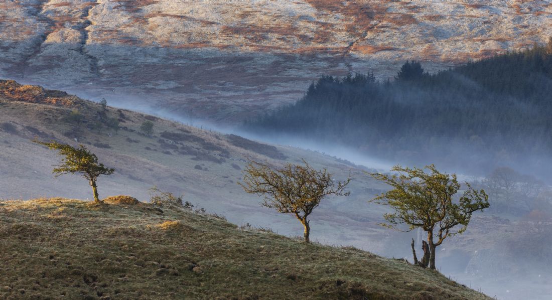
I took this whilst on my way back to the car. The sun had come up and it was burning the low level mist away at quite a rate. I just happened to spot these trees on the edge of the hill. Note the frost on the hill opposite....it was quite a cold may morning !
Another one of my favourite times to take a photo of the castle, early on a spring day. Dolwyddelan castle dominates the landscape and I like to take it at various angles and weather conditions.
It was one of those mornings where there was a threat of heavy rain. I took a gable and headed over to llyn Dinas before the clouds rolled in.
One of the many rivers that run from the mountains surrounding Blaenau Ffestiniog.
The remains of a slate miners terrace of cottages on the foot of Moel Siabod.
A view across to Traeth bach,Portmeirion and in the distance Yr Wyddfa (Snowdon). Taken during an unusually unsettled May.
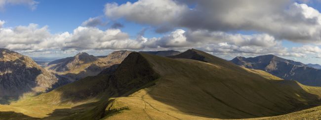
A panoramic consisting of 12 images of the mountains of northern Snowdonia. To the left is Pen yr Ole Wen, Tryfan The Glyder range, Y gGarn and then Yr Wyddfa
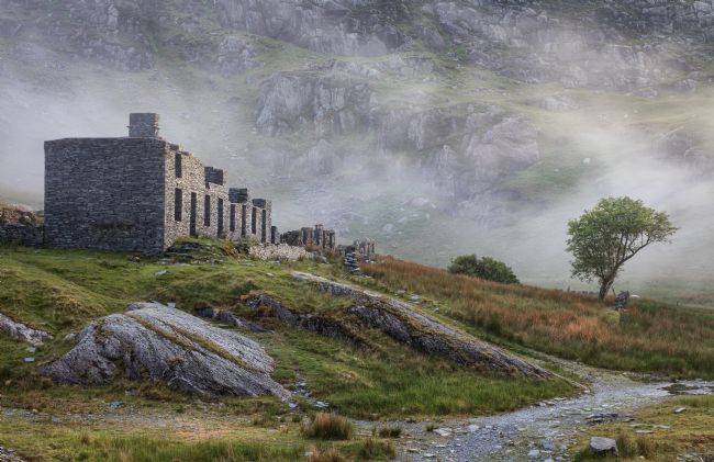
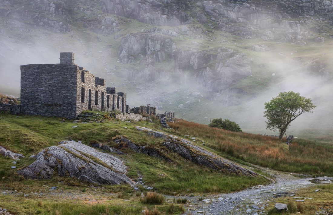
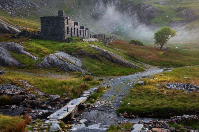
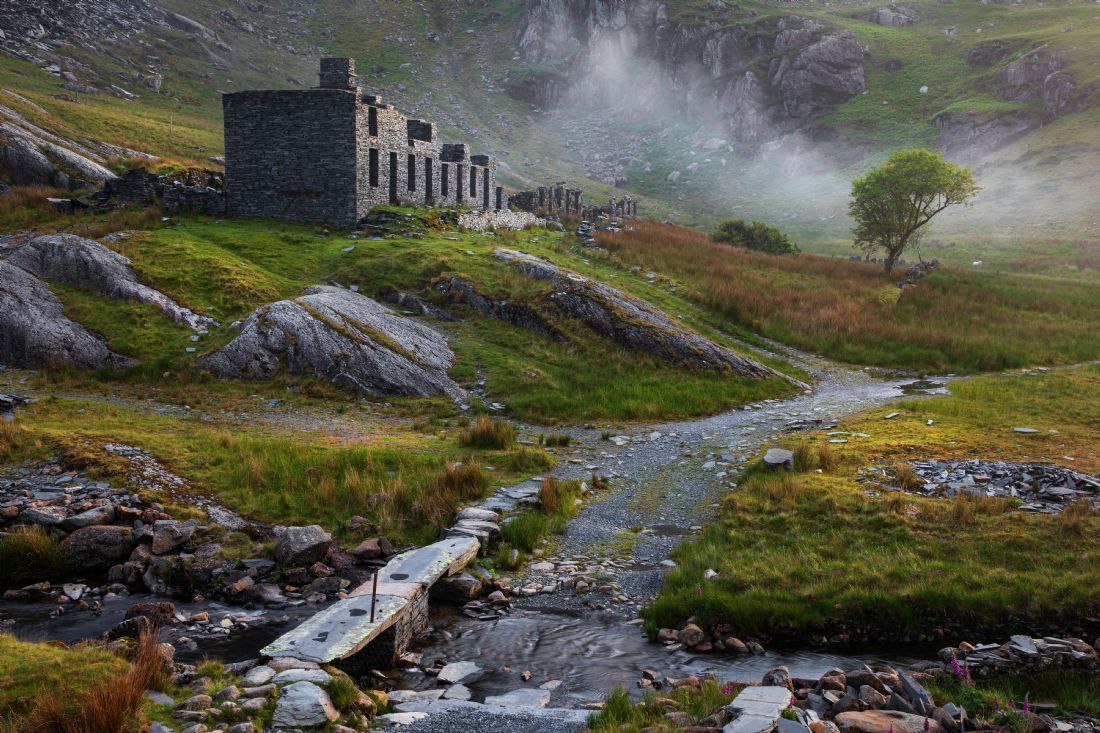
Llyn Conwy is owned by the national Trust. The lake provides a source of drinking water for the Llanrwst and Betws y Coed area.
I decided to pay one more visit to Cwm Edno until winter sets in. There were a few flowers on the Hawthorn tree which I think I just managed to capture before they start falling off. With the camera on the tripod I was waiting for the sun to come up when my dog started growling. I turned around and spotted a Badger hidden in the reeds just behind us. he must have been curious to see what was going on !
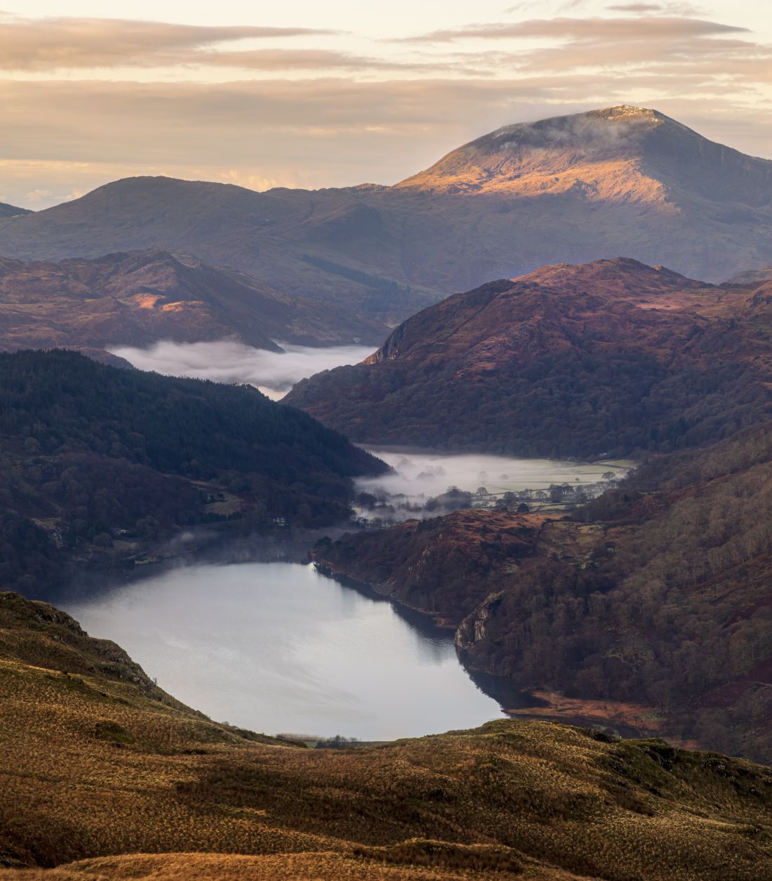
Llyn Gwynant is a lake in the valley called Nantgwynant in the Snowdonia National Park. It is to the north of Beddgellert and on it's west side is the Snowdon mountain range
Dolwyddelan castle is located just off the A470 to the south of a village called Dolwyddelan.
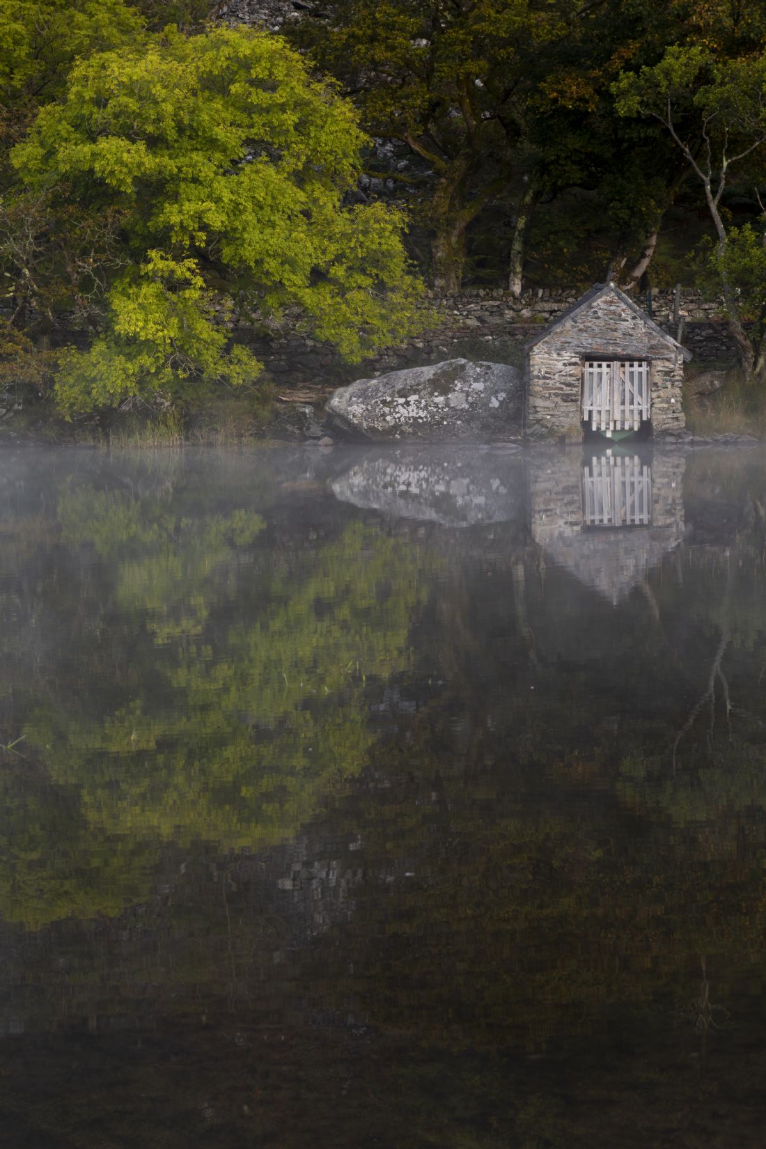
One of the last fishermans boat houses on a lake in Snowdonia called Llyn Dinas. Llyn Dinas is located to the south east of the Snowdon mountain range.
Cwm Edno is a valley to the south of Moel Siabod in the Snowdonia national Park. It is slightly off the beaten track which is a good thing as you can almost have the valley to yourself as it was on this occasion whilst I was taking these photographs.
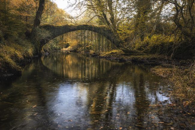
The ancient pack horse bridge at Penmachno in the Snowdonia national Park
A view of Moel Dyrnogydd from Bwlch y Gorddinian or more commonly known as the Crimea pass
An autumnal view of the Aberglaslyn pass near Beddgelert.
An autumnal view of the small welsh village of Beddgelert.
Cnicht a mountain in the snowdonia National Park also known as the Welsh Matterhorn
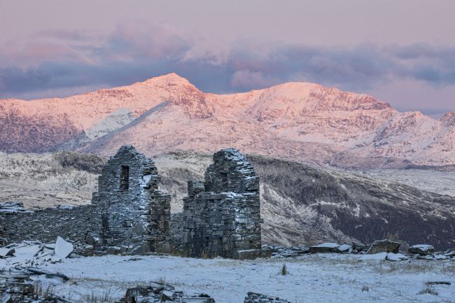
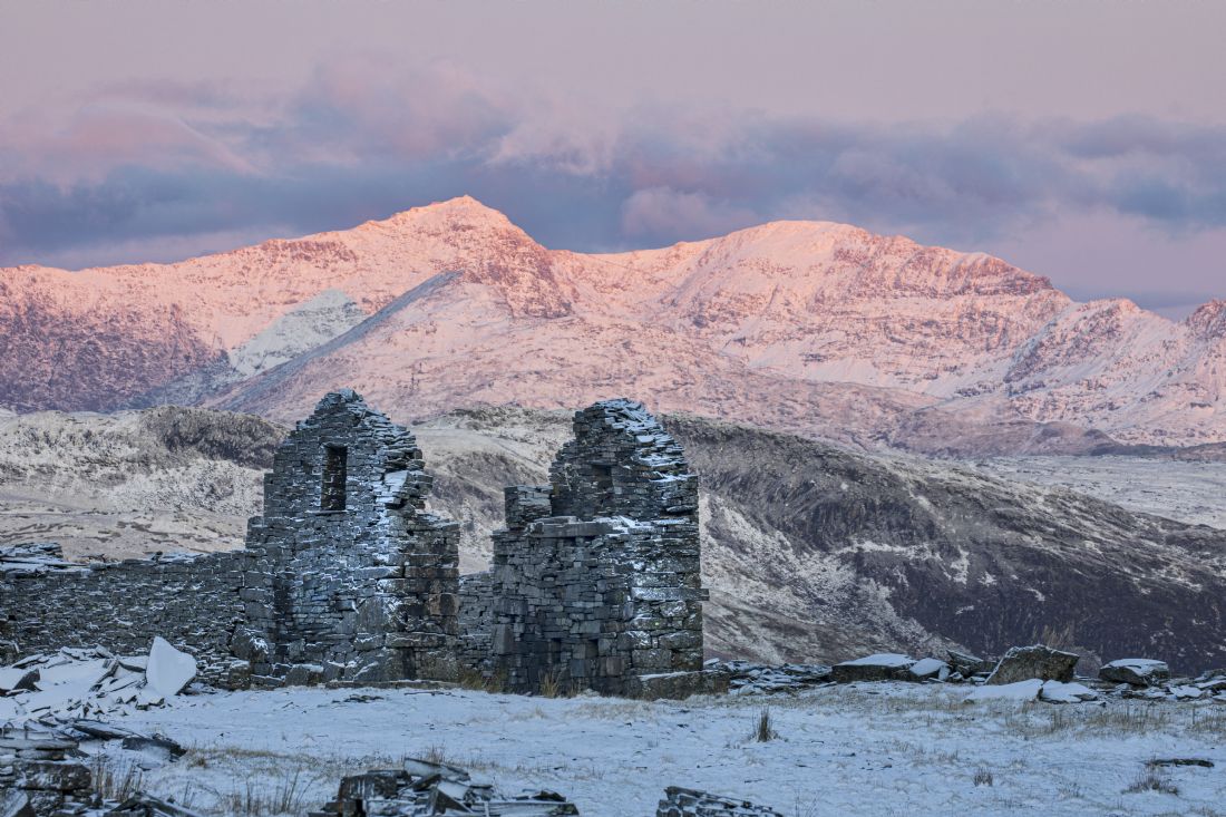
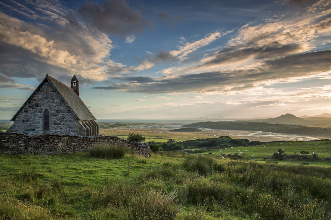
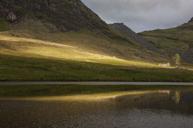
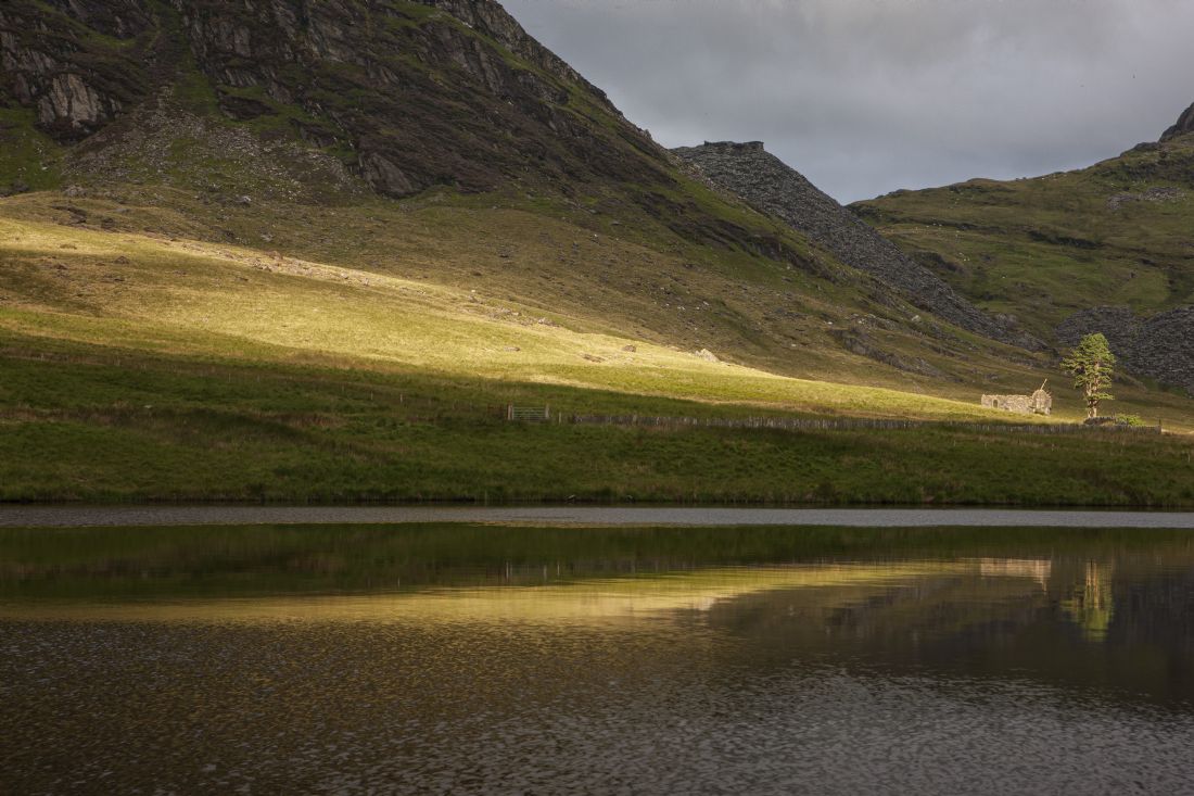
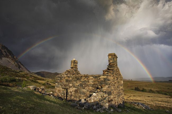
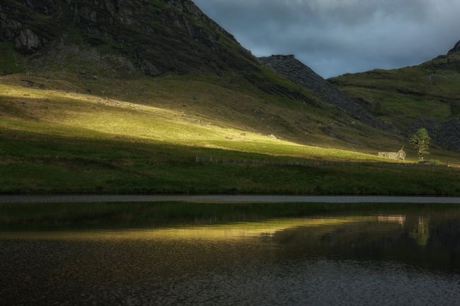
A break in the clouds produced this stunning illumination ending at the old chapel.
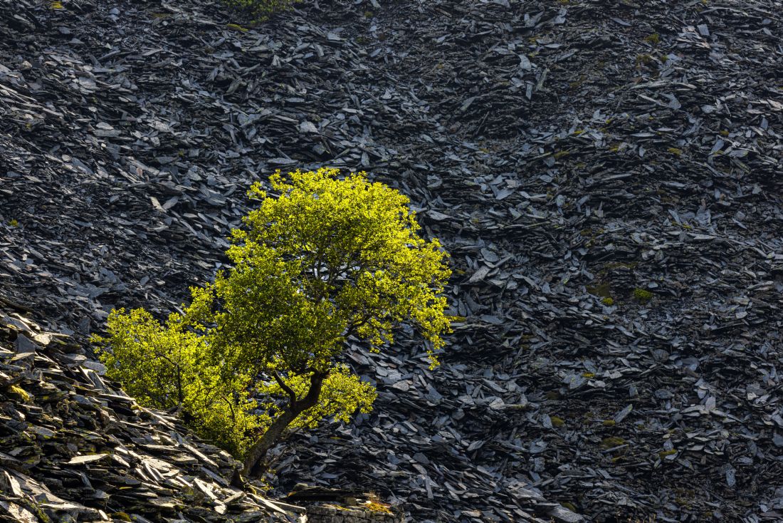
A small tree growing on a boulder just off the lakeside at Cwmorthin
A lake at the heart of the abandoned welsh slate mine at Blaenau ffestiniog. The area is known as Cwm Orthin or Cwmorthin
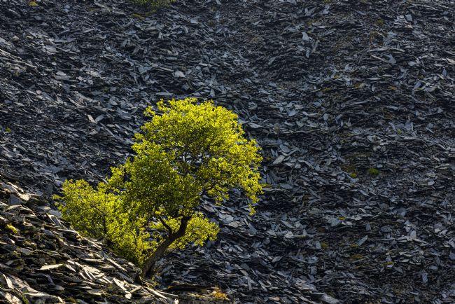
When nature starts to recover. A small tree growing amongst the slate tips of Cwmorthin near Blaenau Ffestiniog
Cregennen consist of two small fishing lakes, one 27 acres (with a small island) and the other half the size at 13 acres. They are located about 785 feet above sea level, beneath the slopes of the Cader Idris mountain range.
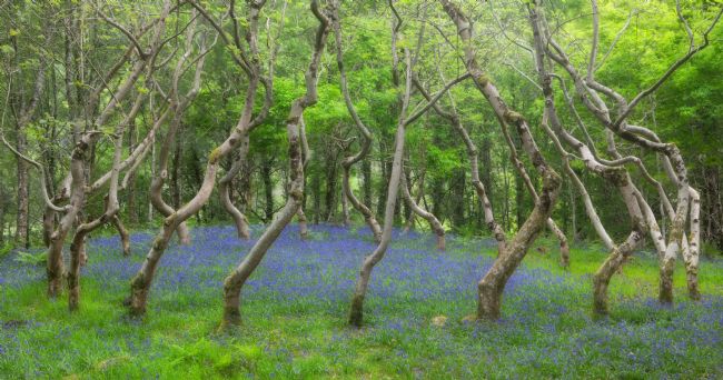
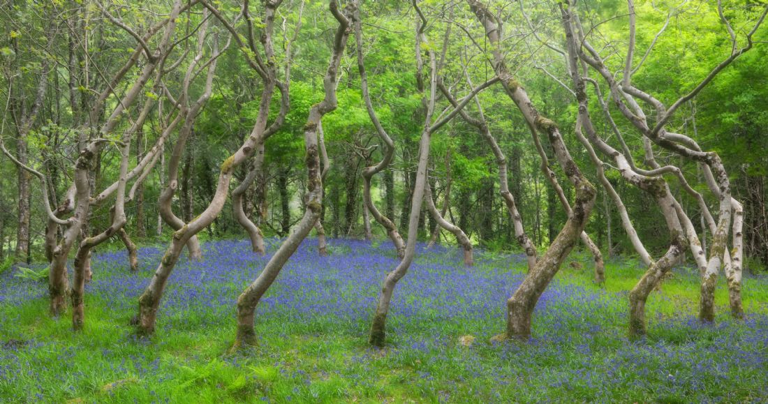
Ash trees formed in a circle give the impression that they are dancing.
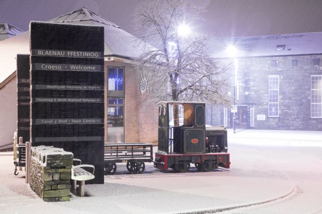
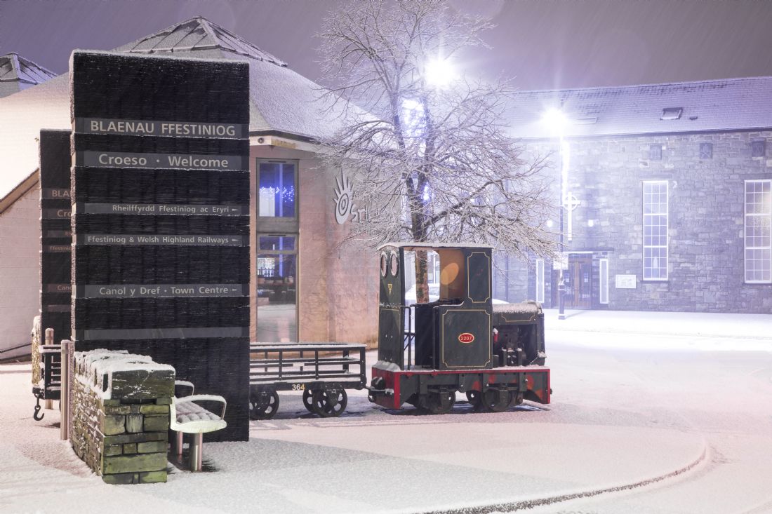
The town centre of Blaenau ffestiniog taken during a snow storm
A long exposure image of Portmeirion under moonlight with the mountains of Snowdonia in the background.
An early morning view of Snowdon from the lakes near Capel Curig.
The Italian village in Snowdonia. Portmeirion was designed and constructed by architect Sir Clough Williams Ellis. It is one of the most popular places in North Wales to visit.
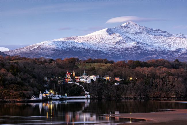
A winter view of Portmeirion with Yr Wyddfa (Snowdon) in the background
A winter view of Cnicht with a dusting of snow and Portmeirion taken from Ynus.
One of the famous carneddau ponies in the southern section of thde Ogwen valley. The ponies run wild across the carneddau mountain ranges. Some of the local farmers do help by feeding them in hard times such as severe snow storms.
Llyn Dywarchen is a small fishing lake to the north west of Yr Wyddfa (Snowdon). It is easily accesible and is worth walking around as the views are stunning.


