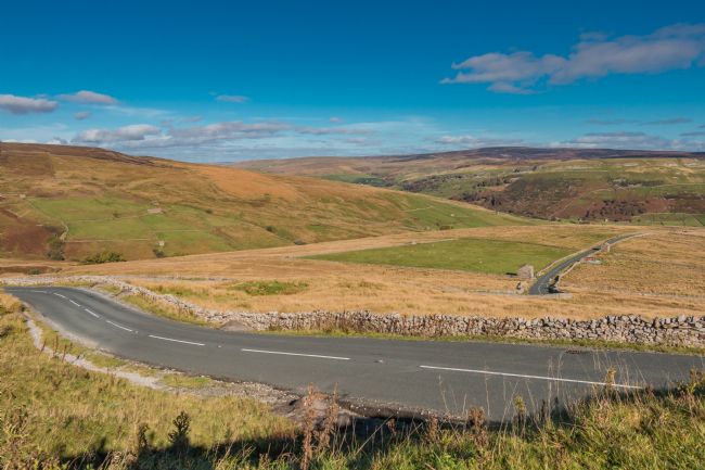
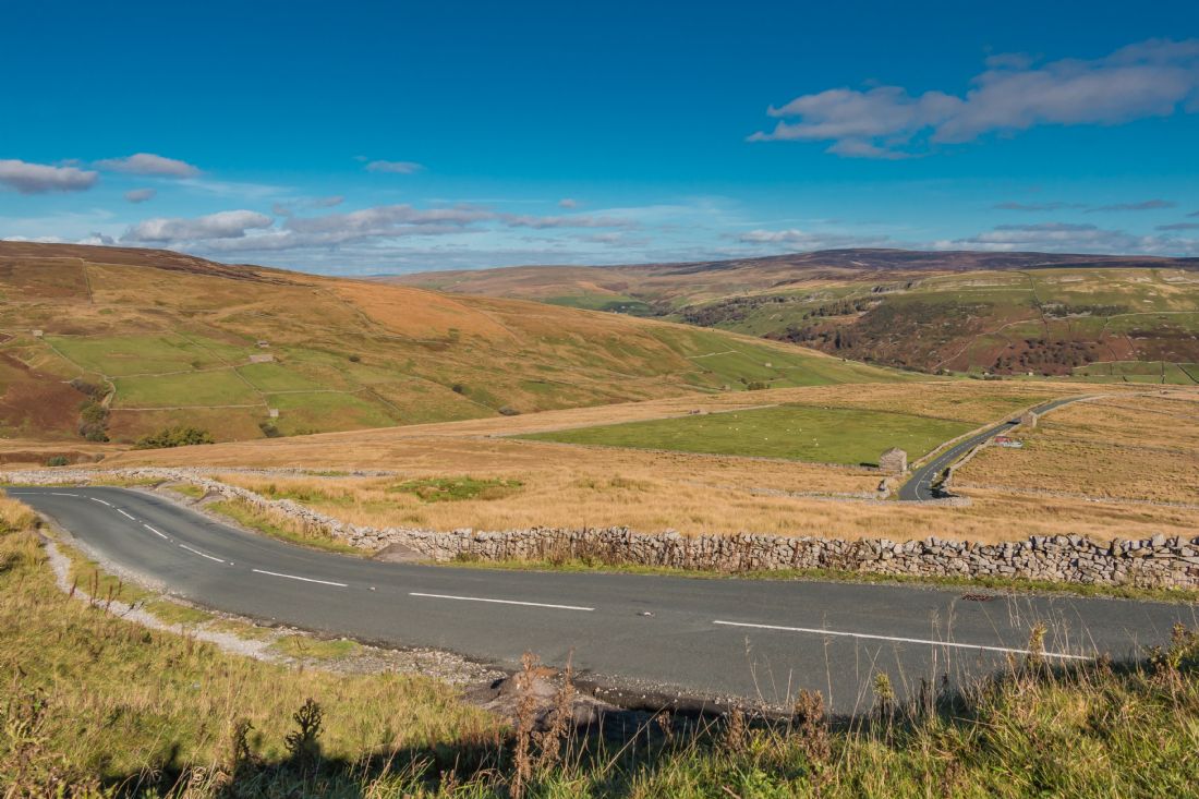
The view into Swaledale, Yorkshire Dales, from the Muker parish boundary close to the summit of the Buttertubs Pass which connects Swaledale with Wensleydale.
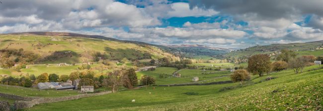
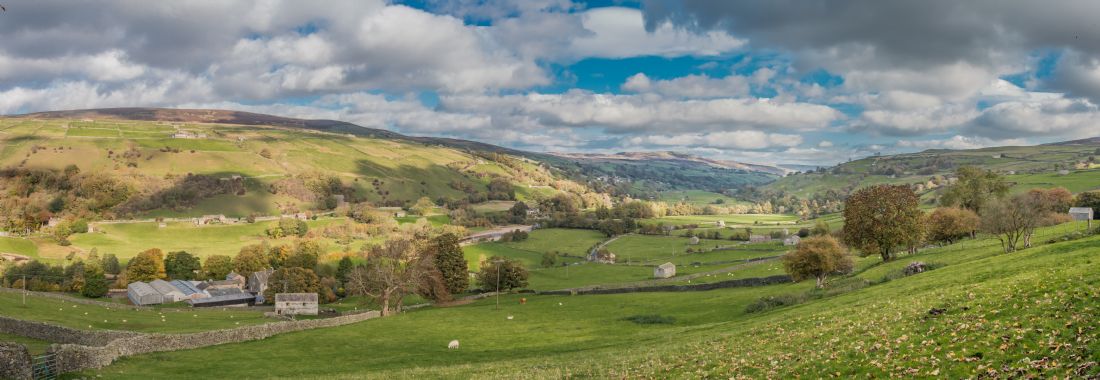
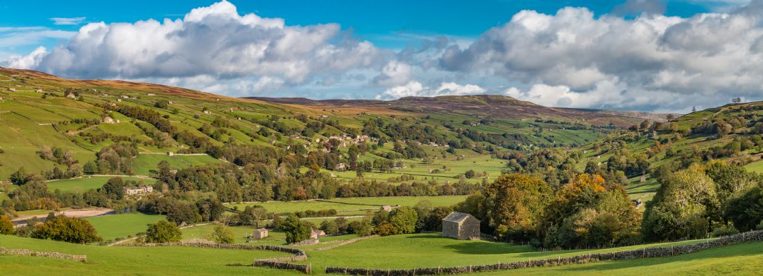
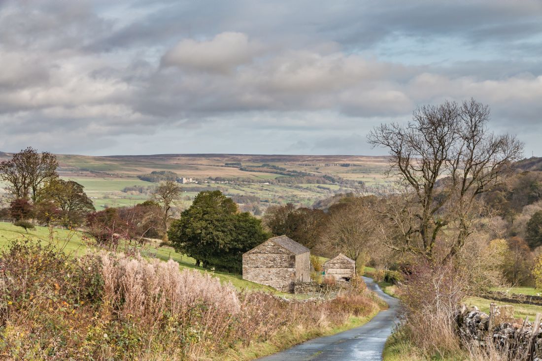
A panoramic autumnal view down Swaledale, within the Yorkshire Dales National Park, taken from the wonderfully named hamlet of Crackpot. The settlement of Low Row can be seen across the valley below Calver Hill.
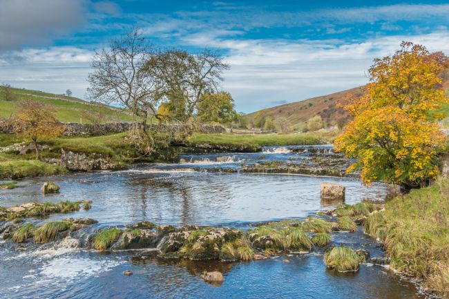
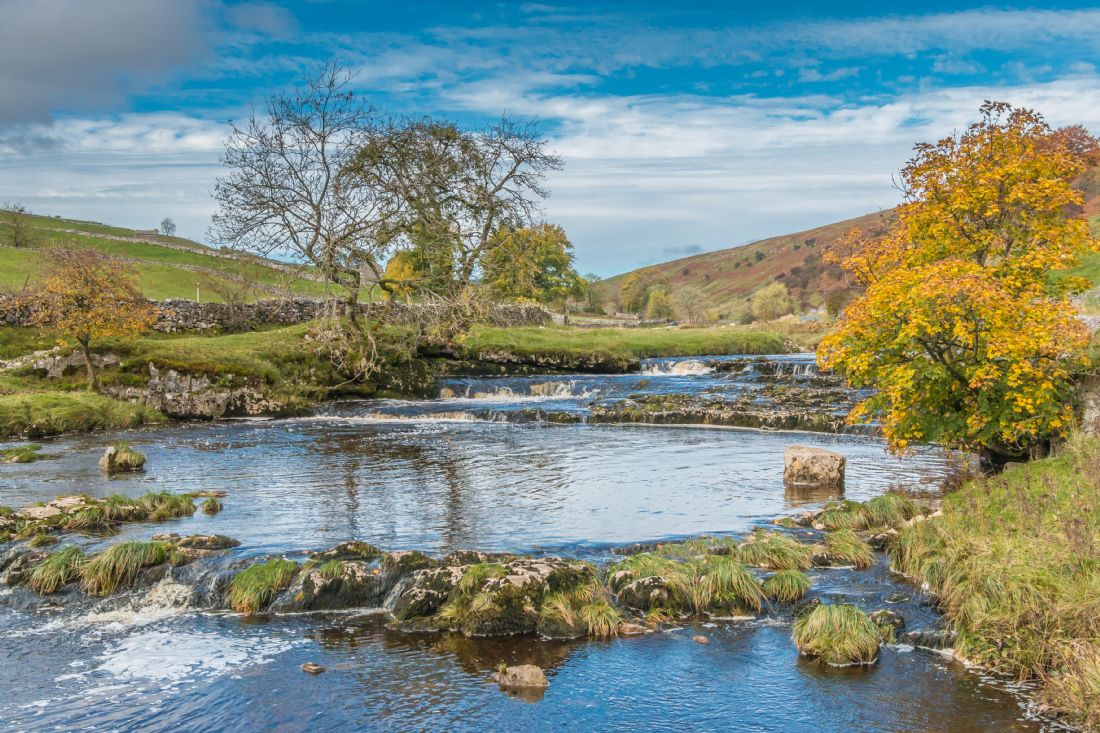
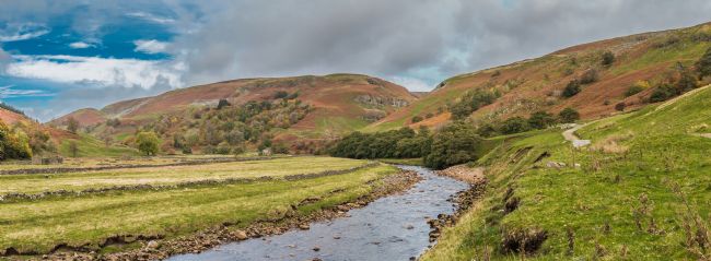
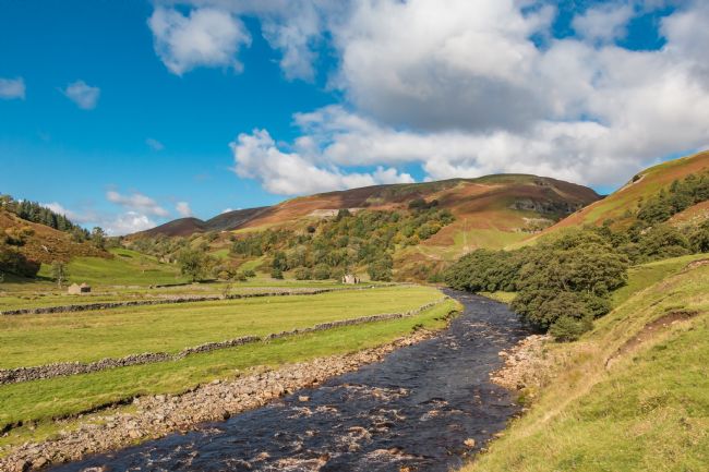
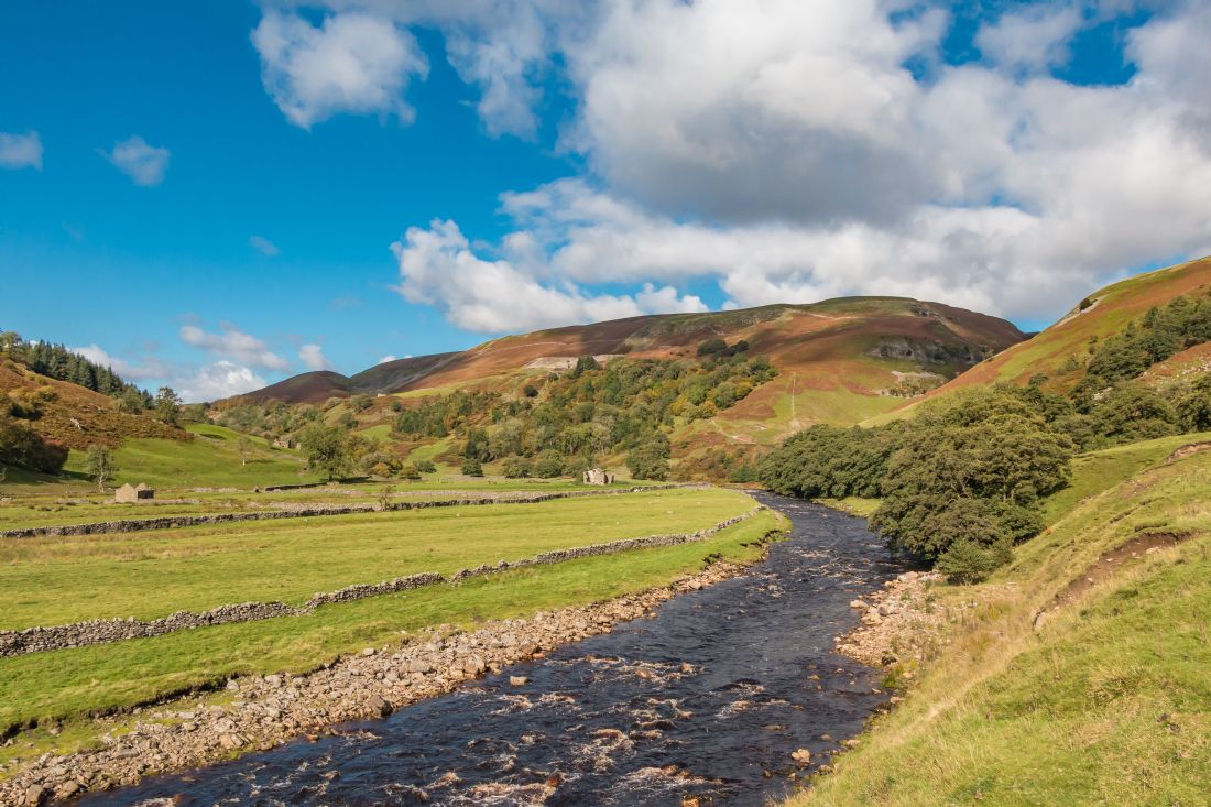
An autumnal view of the upper reaches of the River Wharfe tumbling over cascades as it flows down through Langstrothdale within the Yorkshire Dales National Park
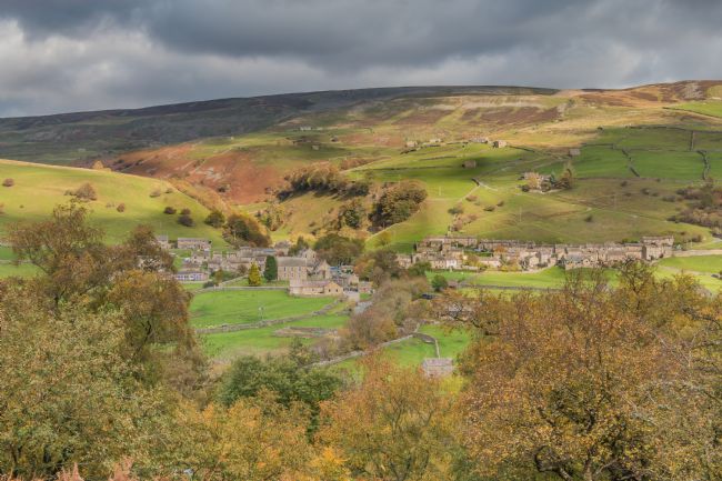
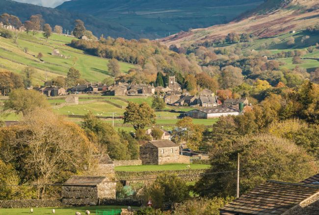
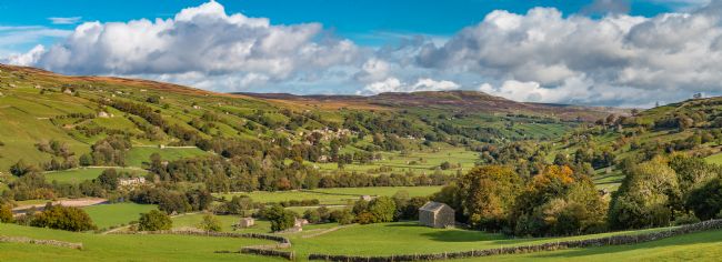
An autumnal view of the village of Gunnerside, Swaledale within the Yorkshire Dales National Park, taken from across the valley at Spring End. Gunnerside was the centre of Swaledale's 19th century lead mining industry, evidence of which still remains in the narrow valley of Gunnerside Gill. The Coast to Coast long distance footpath passes through the village following the river Swale
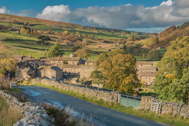
The picturesque village of Muker, in Upper Swaledale within the Yorkshire Dales National Park. The Coast to Coast long distance footpath passes to the north of the village
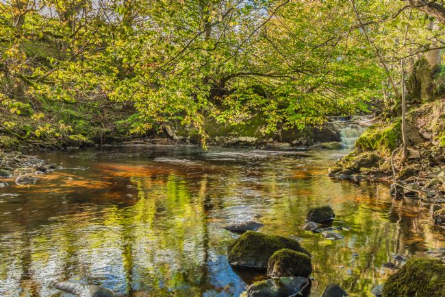
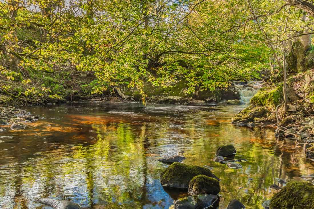
A tranquil pool and cascade with autumn colours and reflections in the stream. Taken on Thwaite Beck, Swaledale, within the Yorkshire Dales National Park
A panoramic view of the River Swale looking upstream towards Keld on the Coast to Coast long distance footpath, Swaledale, Yorkshire Dales
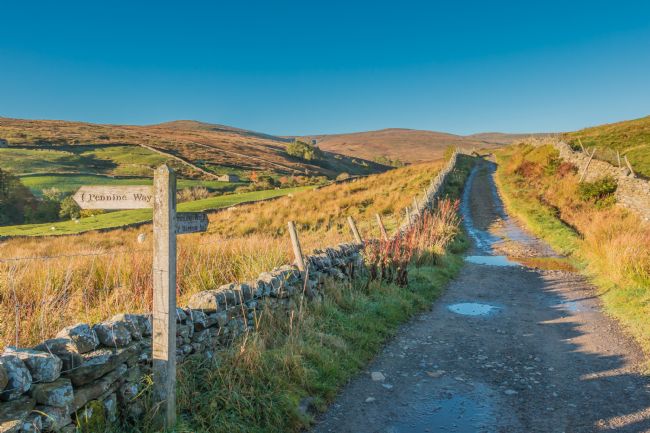
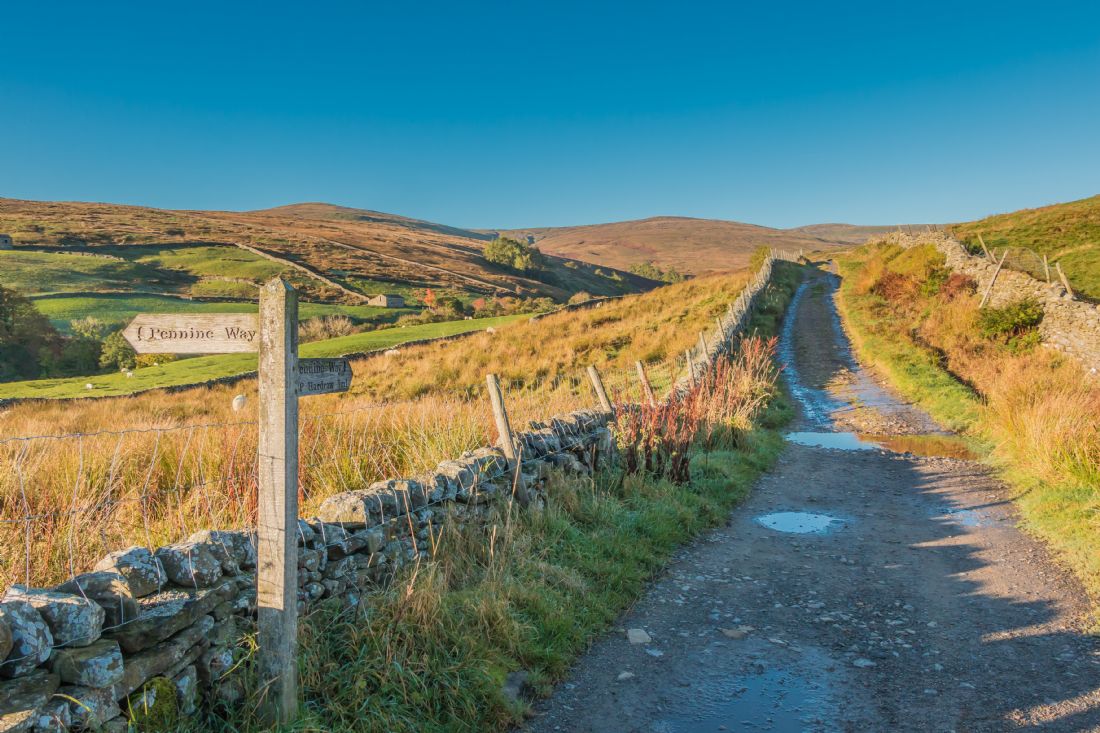
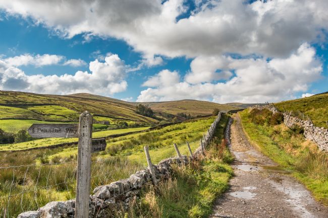
The Pennine Way long distance footpath towards Great Shunner Fell, from the village of Thwaite, Swaledale in brilliant autumn sunshine
The river Swale at Park House, near Keld, Upper Swaledale, within the Yorkshire Dales National Park
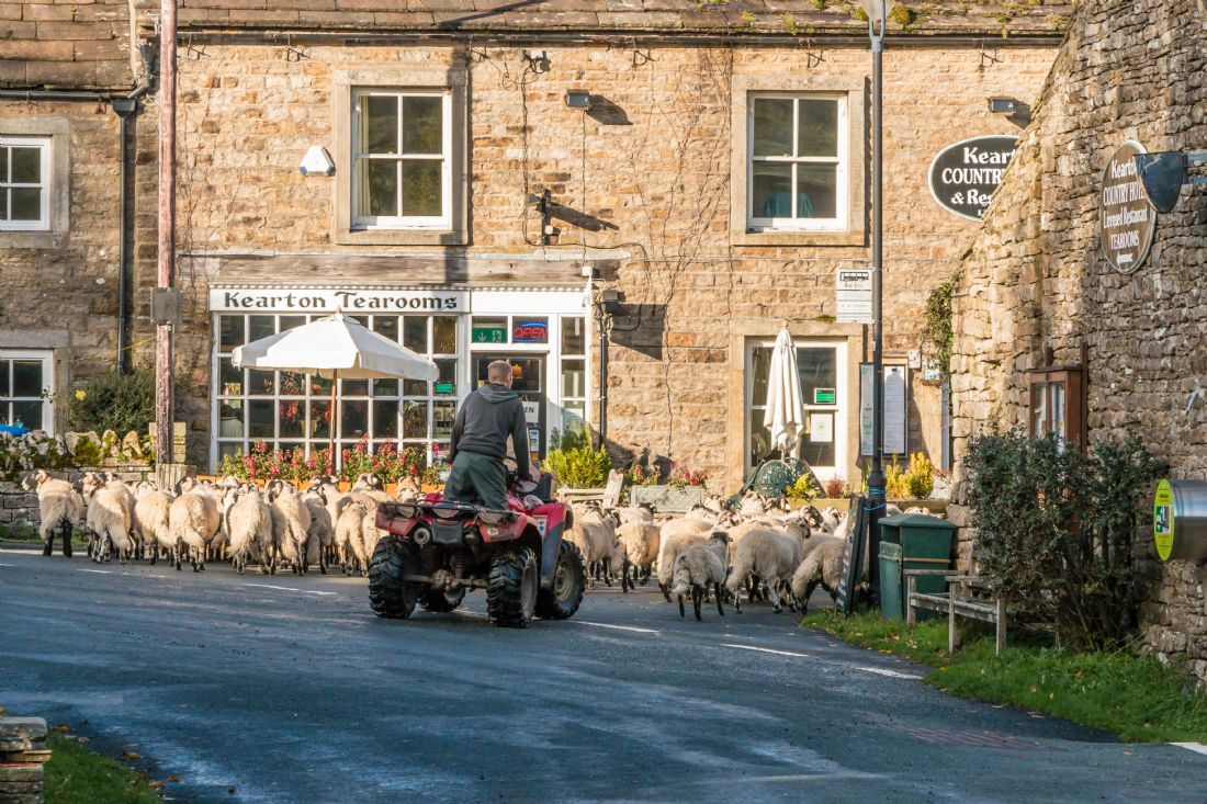
A farmer on a quad bike escorts a flock of Swaledale sheep through the village of Thwaite, Swaledale within the Yorkshire Dales National Park, past the Kearton Tearooms
The Pennine Way long distance footpath crosses from Hardraw in Wensleydale over Great Shunner Fell (the domed hill in the far distance) into Swaledale. At 716m or 2349ft, this is the third highest mountain in the Yorkshire Dales. Here, the track emerges onto the road leading down into Thwaite in Swaledale.
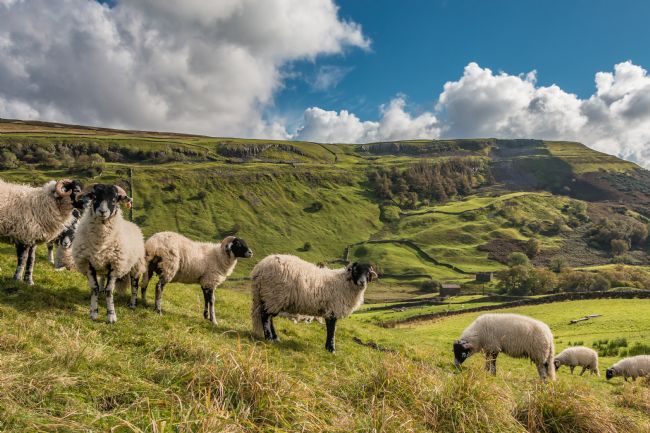
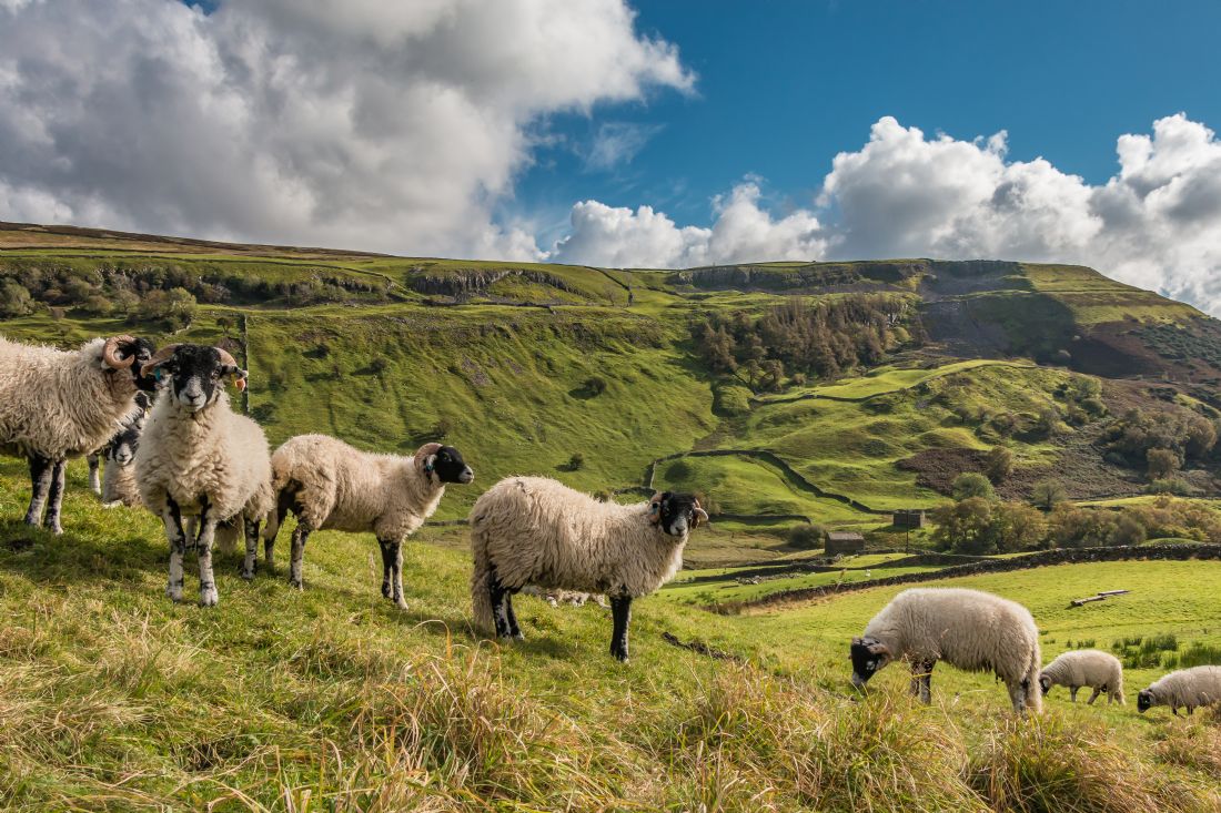
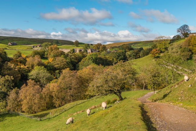
A group of Swaledale sheep eye up the photographer. Taken from Amgram in Upper Swaledale with Kisdon Hill in the background.
A panoramic autumnal view looking down Swaledale towards Low Row, taken from the wonderfully named hamlet of Crackpot.
Autumn colours, strong sunshine and shadows on the landscape in this view upstream towards Beldi Hill. Taken from the Coast to Coast long distance footpath near Swinner Gill between Keld and Muker. Spoil heaps from the disused Beldi Hill lead mine can be seen on the hillside in the distance.
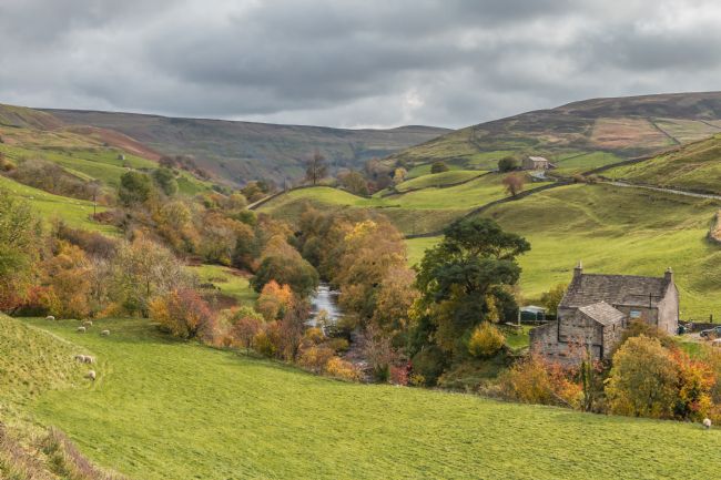
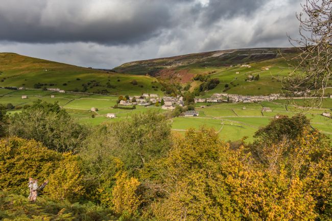
The remote hamlet of Keld, Upper Swaledale in the Yorkshire Dales National Park, with vivid autumn colours in strong sunshine.
Sunshine, shadows and vivid autumn colours in this view across Swaledale to Gunnerside, taken from Spring End. Gunnerside was the centre of Swaledale's lead mining activities, many remnants of which can be found in the steep valley known as Gunnerside Gill behind the village.
Pale watery sunshine on this late autumn view down Walden North road near west Burton, Wensleydale. Castle Bolton on the hillside in the far distance.
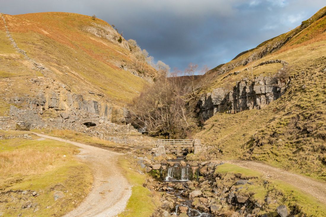
The dramatic Swinner Gill in February Sunshine. The remains of a smelt mill and chimney stretching up the hillside can be seen to the left of the footbridge, which carries the Coast to Coast long distance footpath.
The village of Thwaite, Swaledale, within the Yorkshire Dales National Park, taken on a fine autumn afternoon The Pennine Way long distance footpath passes through the village.


