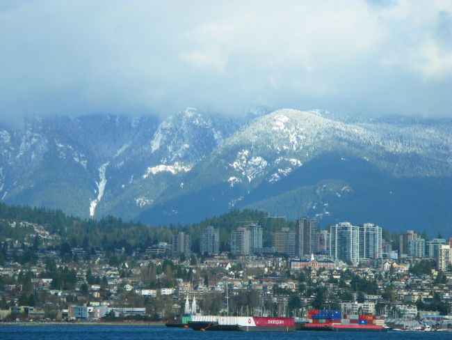
Seen across Vancouver harbour, this wintery shot of North Vancouver with the immediate backdrop of the North Shore Mountains is a typical view, showing the looming and lingering clouds which shroud the mountains in winter and a hint of how close quality skiing really is at higher altitudes!
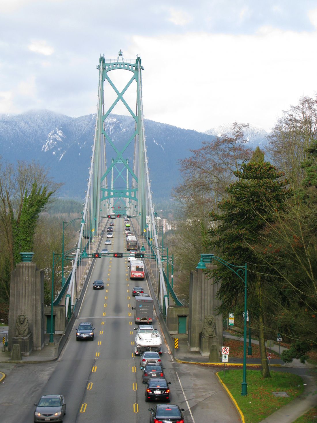
In 1937-8 the Guinness estate built of the Lion's Gate Bridge, linking Vancouver itself to the North Shore communities of North and West Vancouver, allowing them to develop their extensive land holdings on the north side of the Burrard Inlet. The First Narrows, over which this suspension bridge passes, is the main entrance into Vancouver Harbour and required the bridge to be built with a 60m clearance below. The narrows to enter the harbour is a mere 222m wide and suffers a very strong tidal flow. The bridge was a toll bridge until 1963. Its original 2 lane nature was widened to three reversible lanes in the first years of the 21st century, the first time the complete deck of such a suspension bridge was replaced.
This view point, just west of the Lion's Gate Bridge over the narrows in Stanley Park, shows a good day in Vancouver's often grey, blustery, cloudy winter. The entrance to Vancouver Harbour lies through the narrows and the 1930's built Lions Gate suspension bridge soars high over the water, giving access to West Vancouver.
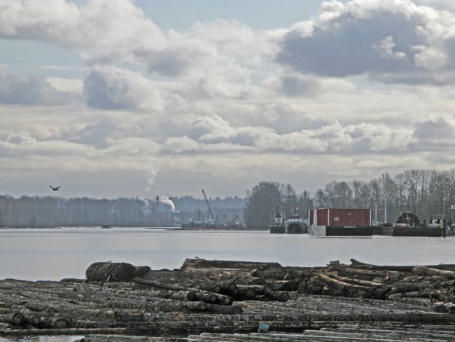
The Fraser River is still in many places a working industrial river as it takes its course between the cities of Vancouver and Richmond, British Columbia, Canada. The tugs and barges are readying, the stocked lumber rafts in the river await their removal to the lumber mill generating steam upstream. At ground level the air is still but chilly and damp, the sky a little threatening and more turbulent.
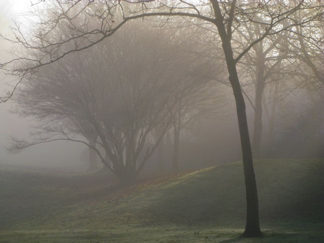
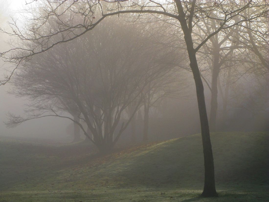
Early morning ground mist and a light fog mingling amoung the trees at sunrise
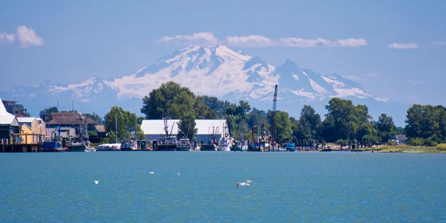
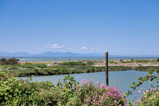
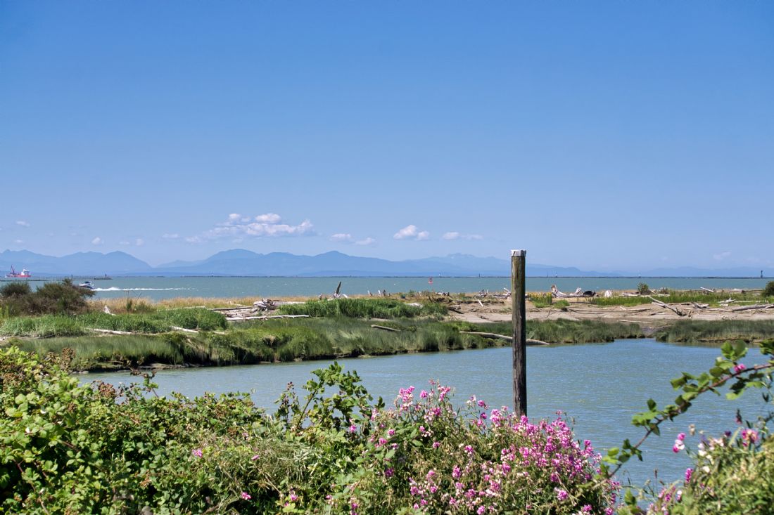
The delta harbor of Steveston, British Columbia, Canada has as a backdrop the enormous active volcano, Mt Baker, in adjacent Washington State, USA. The size of the volcano can be assessed by the fact that it is about 80 km from Steveston.
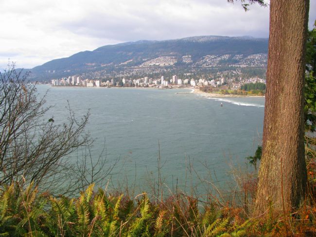
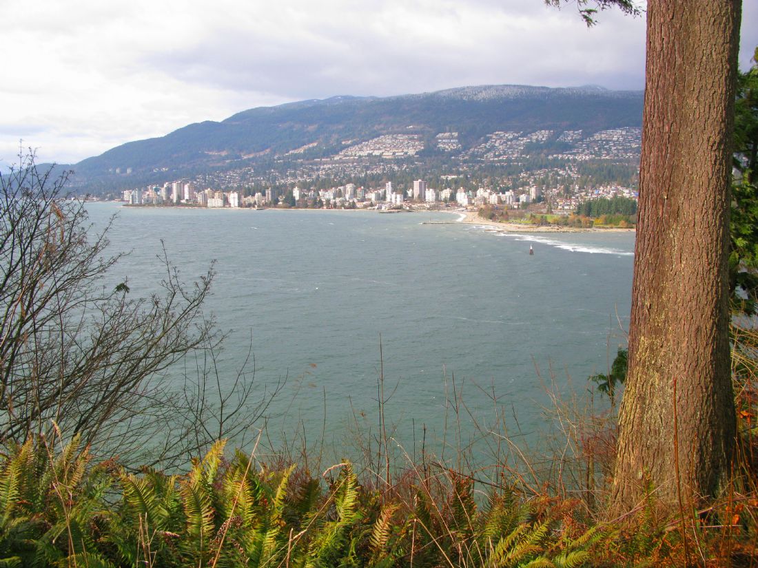
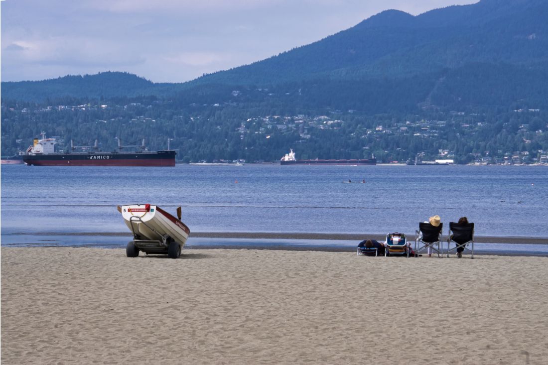
The entire north shore of Point Grey in Vancouver is given over to beaches overlooking English Bay and the North Shore Mountains. Each beach area has its own name and each beach area has its own lifeguard station
The mighty Fraser River in British Columbia spills out into the Salish Sea, through the large delta it has created, at the old fishing community of Steveston. Here, looking north, one can see the North Shore Mountains.
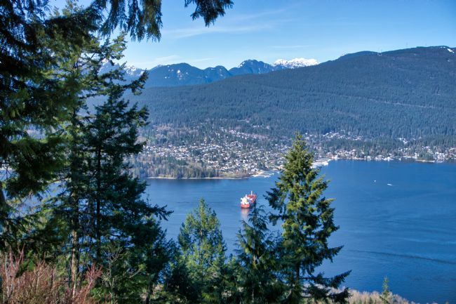
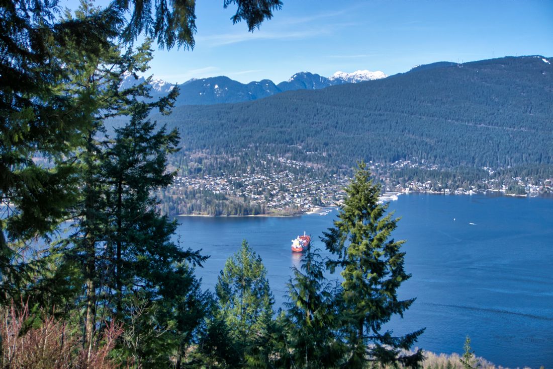
The fjord running inland from Vancouver, known as Indian Arm, presents some wonderful scenery from the water and from the heights well above it. Vancouver Harbour reaches well into Indian arm and substantial ships take moorage there. A lifting bridge at Second Narrows facilitates access.
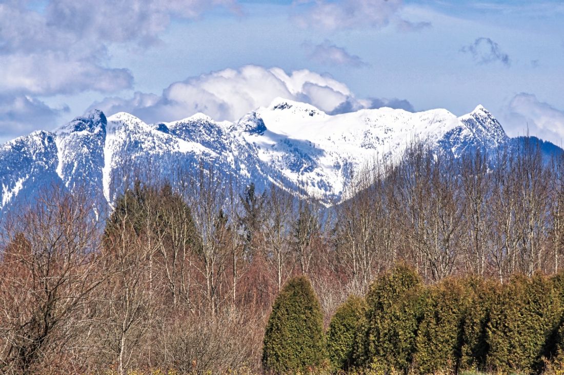
There are many wonderful walks on the norther perimeter of the Fraser Valley east of Vancouver, looking up into the snow covered mountains in Springtime. Sometimes the valley itself is snowbound making walking the banks of the secondary rivers flowing into the mighty Fraser heavy going.
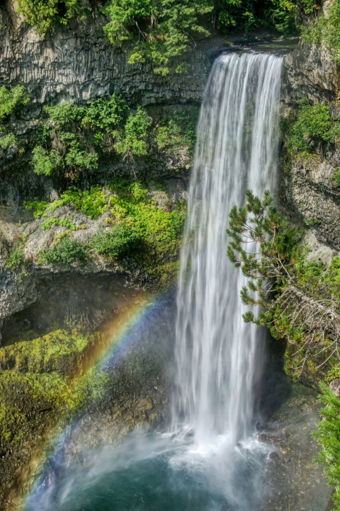
The 66 metre tall (216 feet) Brandywine Falls is a half hour hike in from the road, not far from Whistler BC. It is one of the taller falls in British Columbia and can vary considerably in flow depending on the time of year. In the Spring it is a considerable torrent. This late summer image is more sedate.
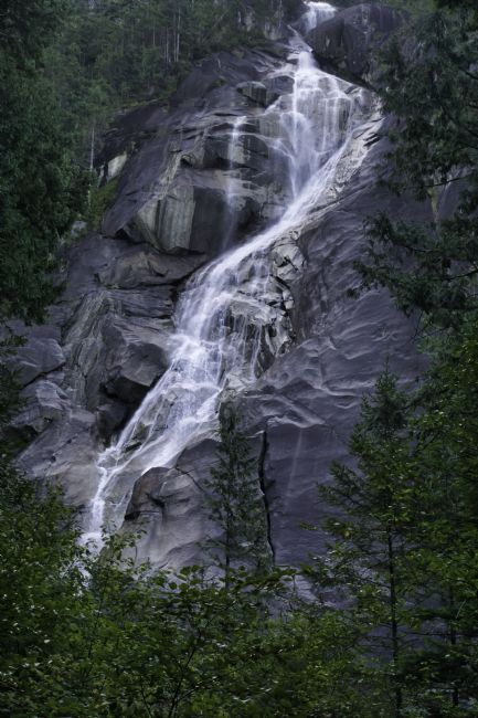
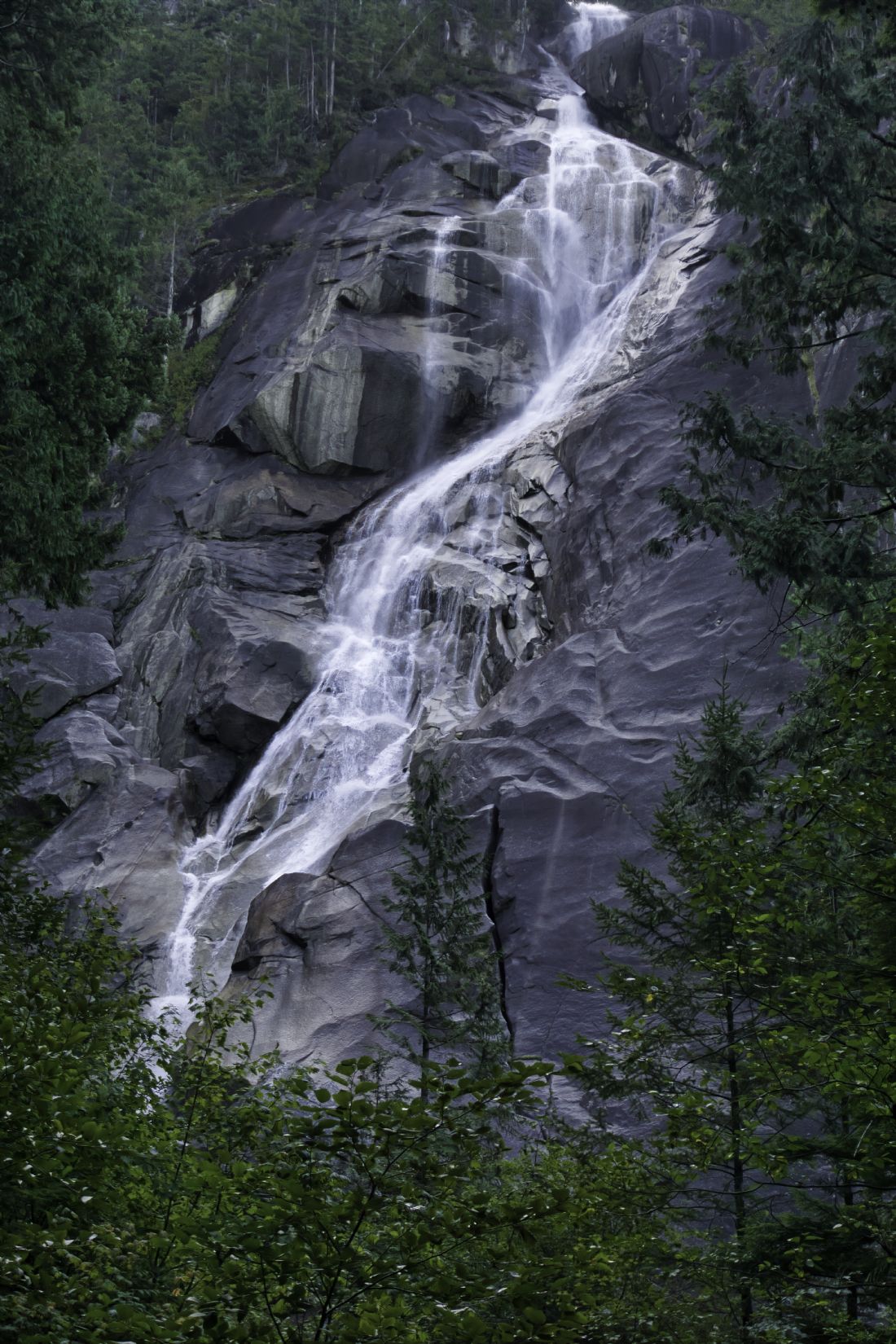
The total height of Shannon Falls is 335 metres ( 1,105 ft), the 3rd highest falls in British Columbia, tumbling out of the mountains south of Squamish into the depths of Howe Sound, a major coastal ford. This image shows only the middle 1/3 of the falls, itself higher than Niagara Falls in Ontario, which are only 99 metres high (324 ft).
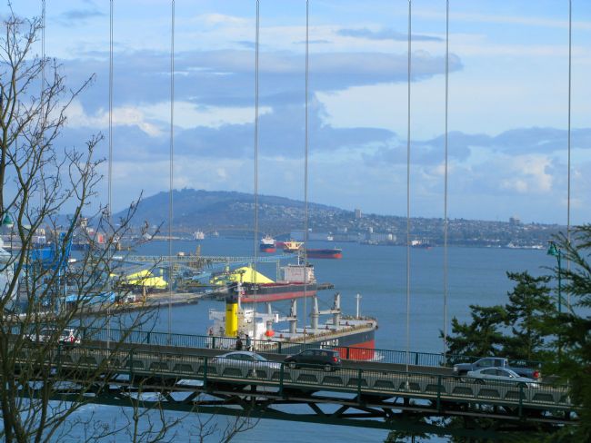
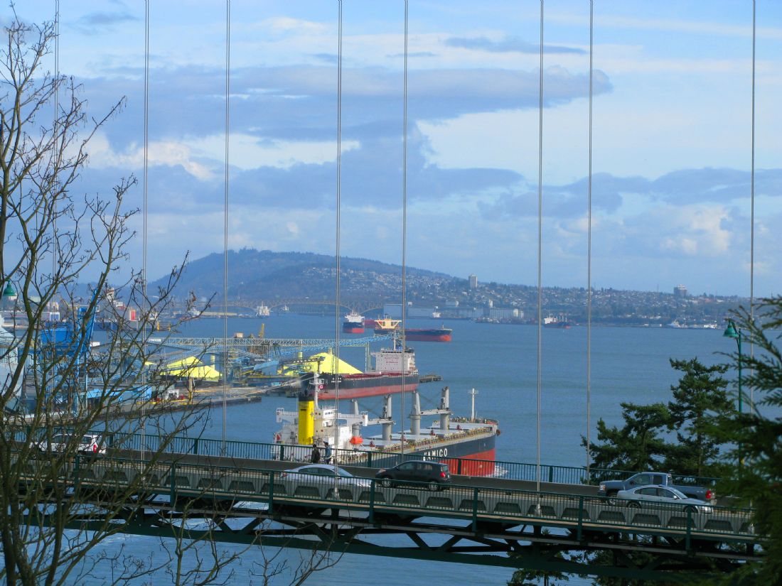
Looking across Lion's Gate Bridge, showing the very narrow and tidally treacherous entry into Burrard Inlet and Vancouver's inner harbour, looking east. Burrard Inlet is a fjord which travels east for a short way then turns north deeply into the mountains for about 30kms up Indian Arm. In the distance can be seen the Second Narrows bridge, there only being two crossings of the inlet linking Vancouver to its outlying communities. The hill to the south of the second narrows is Burnaby Mountain, the home of Simon Fraser Univsersity. Vancouver's sheltered harbour is an extremely busy enterprise.
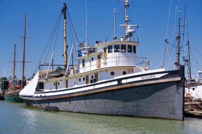
The oldest operable ocean tug on the west coast of Canada, Ku'ulahkai was built in 1944. She now resides in Steveston, British Columbia, at the mouth of the Fraser River delta.
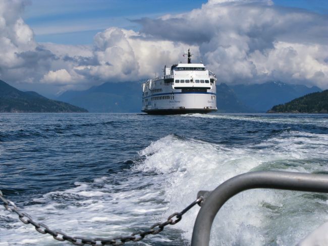
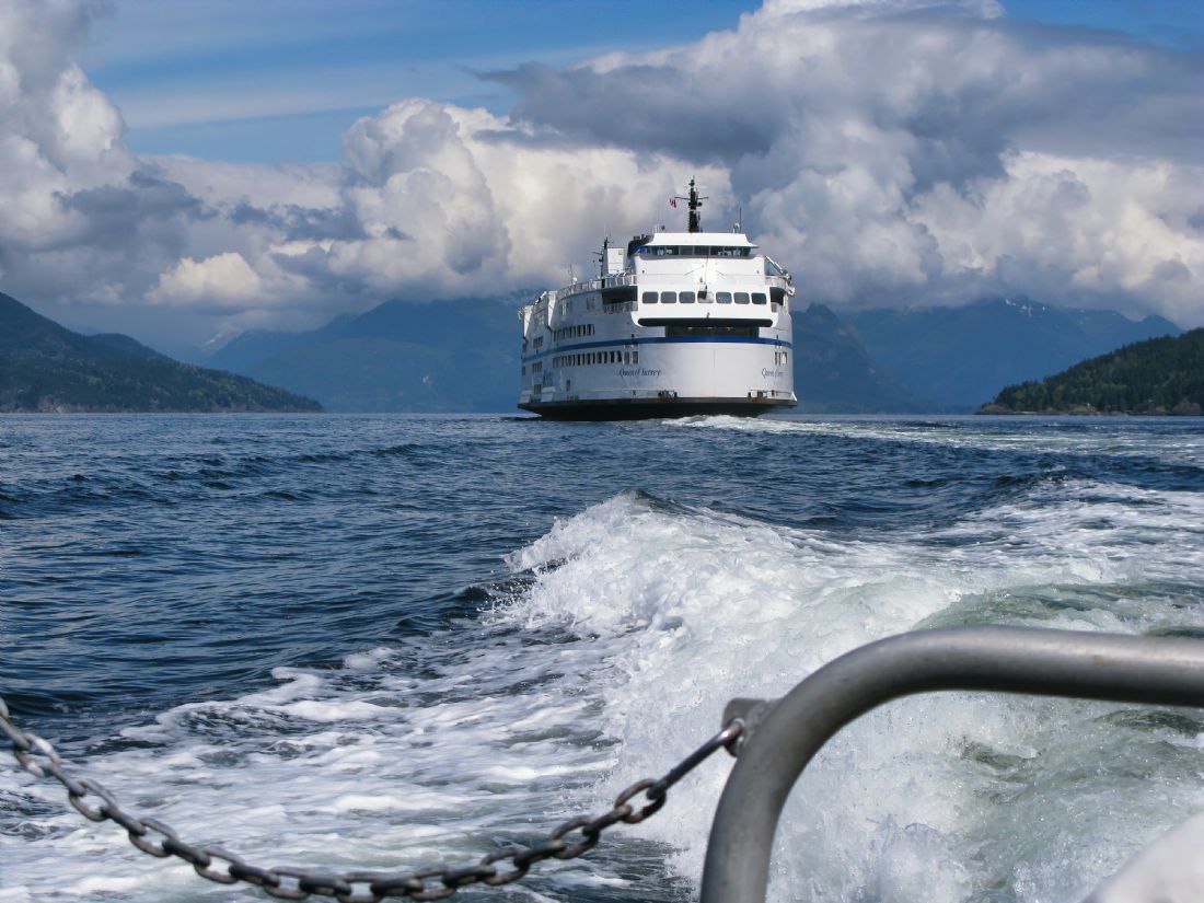
One of the coastal ferries between the mainland of British Columbia en route to Vancouver Island
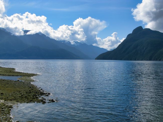
The coast of British Columbia, from Vancouver north, is deeply riven with flooded glaciated valleys


